
Website northyorkmoors.org.uk | ||
 | ||
Similar | ||
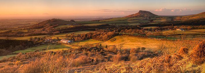
Clay bank the cleveland hills north york moors 12 november 2016
The Cleveland Hills are a range of hills on the north-west edge of the North York Moors in North Yorkshire, England, overlooking Cleveland and Teesside. They lie entirely within the boundaries of the North York Moors National Park. Part of the 110-mile (177 km) long Cleveland Way National Trail runs along the hills, which is a part of Wainwright's Coast to Coast Walk. The hills, which rise abruptly from the flat Tees Valley to the north, include distinctive landmarks such as the cone-shaped peak of Roseberry Topping, near the village of Great Ayton – childhood home of Captain James Cook.
Contents
- Clay bank the cleveland hills north york moors 12 november 2016
- Map of Cleveland Hills Middlesbrough UK
- Formation
- Early man
- Stone circles in the Cleveland Hills
- Mining and industry
- Hill data
- Towns and villages in the Cleveland Hills
- Interesting places to see
- References
Map of Cleveland Hills, Middlesbrough, UK
Formation
Geological studies of the Cleveland Hills plateau date the rocks back to the Middle Jurassic age, making the range approximately 161–176 million years old, although the North York Moors are formed on rocks from the Lower Jurassic age resulting in shale erosion along the north and west faces of the hills. Roseberry Topping is an outlier which was formed as a result of erosion, separating it from the Cleveland Hills formation, making it a unique natural hill.
Early man
There are a number of tumuli and stone circles scattered throughout the Cleveland Hills and North York Moors, dating back to the Bronze Age, as well as many cairns that are of varied ages, some of which are relatively modern. Hundreds of flint arrowheads have been discovered during excavations in the hills and dated to the Mesolithic and Neolithic periods, indication of an active population in prehistoric times across the region.
Stone circles in the Cleveland Hills
Mining and industry
In 1850 ironstone was discovered by John Marley of Bolckow and Vaughan in the Eston Hills, outliers of the Cleveland Hills, leading to mining on a large scale and the rapid growth of nearby Middlesbrough. By the 1870s industry would be producing steel in vast amounts, and mining for coal, alum, jet, cement stone concretions, shale and potash from the hills, as well as employing sandstone and limestone quarries to gather raw materials. Many of the mines and quarries are still evident today.
Hill data
The following heights are some of the highest or most notable in the range.
Towns and villages in the Cleveland Hills
There are numerous towns and villages on, or in the vicinity of, the Cleveland Hills including the following:
Interesting places to see
Bilsdale West Moor, situated in the Cleveland Hills, is home to the 314 metres (1,030 ft) tall Bilsdale transmitting station, providing 40–50 miles coverage of UHF transmissions for digital TV and radio in the north-east's Tyne Tees region. The digital switchover at Bilsdale was completed in two stages, on 12 and 26 September 2012, one of the last transmitters in England to complete this operation, the others being Pontop Pike and Chatton in the same region.