
Area 2,893 km² Population 10,473 (2013) | Website www.co.clay.tx.us Founded 1857 | |
 | ||
Rivers Red River of the South, Wichita River, Russell Creek | ||
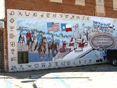
120 acres clay county texas
Clay County is a county located in the U.S. state of Texas. As of the 2010 census, its population was 10,752. The county seat is Henrietta. The county was founded in 1857 and later organized in 1860. It is named in honor of Henry Clay, famous American statesman, Kentucky Senator and United States Secretary of State.
Contents
- 120 acres clay county texas
- Map of Clay County TX USA
- Geography
- Adjacent counties
- Demographics
- Major highways
- Cities
- Town
- References
Map of Clay County, TX, USA
Clay County is part of the Wichita Falls, Metropolitan Statistical Area in North Texas.
Several railroads once served Clay County, including the Wichita Falls Railway, one of the properties of Joseph A. Kemp and his brother-in-law Frank Kell, along with twenty-nine other stockholders. The Wichita Falls Railway linked Henrietta with Wichita Falls. Built in 1894-1895, it was sold in 1911 to the Missouri-Kansas-Texas Railroad, also known as the Katy. The original eighteen miles of track was abandoned in 1970.
The Wichita Falls rancher, oilman, and philanthropist Joseph Sterling Bridwell owned a ranch in Clay County, among his multiple holdings.
Clay County is represented in the Texas House of Representatives by the Republican James Frank, a businessman from Wichita Falls.
Geography
According to the U.S. Census Bureau, the county has a total area of 1,117 square miles (2,890 km2), of which 1,089 square miles (2,820 km2) is land and 28 square miles (73 km2) (2.5%) is water.
Lake Arrowhead State Park, a 524-acre (212 ha) development on Lake Arrowhead in Clay County, encompasses 14,390-acre (5,820 ha) acres. The lakeshore extends 106 miles; the park offers bicycling, birding, boating, camping, canoeing, fishing, hiking, horseback riding, nature study, picnicking, swimming, and wildlife observation.
Adjacent counties
Demographics
As of the census of 2000, there were 11,006 people, 4,323 households, and 3,181 families residing in the county. The population density was 10 people per square mile (4/km²). There were 4,992 housing units at an average density of 4 per square mile (2/km²). The racial makeup of the county was 95.35% White, 0.42% Black or African American, 1.03% Native American, 0.10% Asian, 0.01% Pacific Islander, 1.68% from other races, and 1.42% from two or more races. 3.67% of the population were Hispanic or Latino of any race.
There were 4,323 households out of which 30.70% had children under the age of 18 living with them, 63.20% were married couples living together, 7.30% had a female householder with no husband present, and 26.40% were non-families. 23.50% of all households were made up of individuals and 11.80% had someone living alone who was 65 years of age or older. The average household size was 2.52 and the average family size was 2.98.
In the county, the population was spread out with 24.90% under the age of 18, 6.80% from 18 to 24, 26.40% from 25 to 44, 25.90% from 45 to 64, and 16.10% who were 65 years of age or older. The median age was 40 years. For every 100 females there were 94.00 males. For every 100 females age 18 and over, there were 93.10 males.
The median income for a household in the county was $35,738, and the median income for a family was $41,514. Males had a median income of $28,914 versus $20,975 for females. The per capita income for the county was $16,361. About 8.10% of families and 10.30% of the population were below the poverty line, including 11.70% of those under age 18 and 11.00% of those age 65 or over.