
Founded January 2, 1822 Website www.claycountymo.gov Population 230,473 (2013) Unemployment rate 4.8% (Apr 2015) | Area 1,059 km² | |
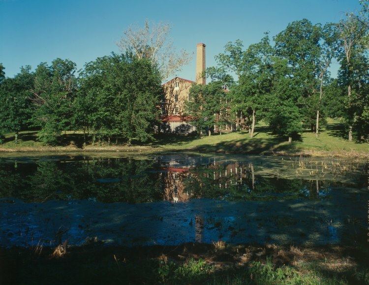 | ||
Points of interest Liberty Jail, Worlds of Fun, Watkins Woolen Mill State, Penguin Park, Macken Park Colleges and Universities William Jewell College, Midwestern Baptist Theologic, Vatterott College, Metropolitan Community College, Donna's Academy of Hair D | ||
11 10 14 jefferson highway clay county missouri from north kansas city to kansas city missouri
Clay County is a county located in the U.S. state of Missouri. As of the 2010 census, the county had a population of 221,939, making it the fifth-most populous county in Missouri. Its county seat is Liberty. The county was organized January 2, 1822, and named in honor of U.S. Representative Henry Clay from Kentucky, later member of the United States Senate and United States Secretary of State.
Contents
- 11 10 14 jefferson highway clay county missouri from north kansas city to kansas city missouri
- Map of Clay County MO USA
- History
- Geography
- Adjacent counties
- Demographics
- Public schools
- Private schools
- Postsecondary
- Local
- State
- Federal
- Notable natives
- References
Map of Clay County, MO, USA
Clay County is part of the Kansas City, MO-KS Metropolitan Statistical Area and contains many of the city's northern suburbs, along with a substantial portion of the City of Kansas City.
Clay County owns and operates the Midwest National Air Center in Excelsior Springs.
History
Clay County was settled primarily from migrants from the Upper Southern states of Kentucky, Tennessee, and Virginia. They brought slaves and slaveholding traditions with them, and quickly started cultivating crops similar to those in Middle Tennessee and Kentucky: hemp and tobacco. Clay was one of several counties settled mostly by Southerners to the north and south of the Missouri River. Given their culture and traditions, this area became known as Little Dixie. In 1860, slaves made up 25% or more of the county's population. Residents generally supported the Confederacy during the Civil War, as the Confederate flag flew over the county courthouse for many years following the end of the Civil War.
Many members of the Latter Day Saint movement found refuge in Clay County in November 1833. In 1836, mobs drove the members of the church from the county. Leaders of this church, most notably Joseph Smith, were imprisoned for some months in Clay County in the jail at Liberty. In May 2012, the LDS Church opened a Kansas City Missouri Temple six miles southwest of the Liberty Jail site at 7001 Searcy Creek Parkway in Kansas City, Missouri.
Geography
According to the U.S. Census Bureau, the county has a total area of 409 square miles (1,060 km2), of which 397 square miles (1,030 km2) is land and 11 square miles (28 km2) (2.8%) is covered by water. It is the fourth-smallest county in Missouri by area.
Adjacent counties
Demographics
As of the census of 2010, 221,939 people, 72,558 households, and 50,137 families resided in the county. The population density was 558 people per square mile (216/km²). The 93,918 housing units averaged 236 per square mile (91/km2). The racial makeup of the county was 87.46% White, 5.18% Black or African American, 0.53% Native American, 2.05% Asian, 0.26% Pacific Islander, 1.77% from other races, and 2.75% from two or more races. About 5.90% of the population were Hispanic or Latino of any race. As of the census of 2000, 23.3% were of German, 14.5% American, 11.0% English, 10.8% Irish, and 5.6% Italian ancestry.
Of the 72,558 households, 33.80% had children under the age of 18 living with them, 55.40% were married couples living together, 10.20% had a female householder with no husband present, and 30.90% were not families. About 25.20% of all households were made up of individuals, and 7.40% had someone living alone who was 65 years of age or older. The average household size was 2.50 and the average family size was 3.00.
In the county, the population was distributed as 25.80% under the age of 18, 8.70% from 18 to 24, 32.30% from 25 to 44, 22.30% from 45 to 64, and 10.80% who were 65 years of age or older. The median age was 35 years. For every 100 females, there were 94.60 males. For every 100 females age 18 and over, there were 91.80 males.
The median income for a household in the county was $48,347, and for a family was $56,772. Males had a median income of $40,148 versus $27,681 for females. The per capita income for the county was $23,144. About 3.80% of families and 5.50% of the population were below the poverty line, including 6.40% of those under age 18 and 5.50% of those age 65 or over.
Registered voters number 151,042.
Public schools
Private schools
Postsecondary
Local
The three-person Clay County Commission oversees the issues of Clay County. The current makeup of the commissioners is two Republicans and one Democrat.
State
Clay County is divided into six legislative districts in the Missouri House of Representatives, five of which are held by Republicans and one by a Democrat.
Clay County is divided into two districts in the Missouri Senate, both of which are held by Republicans.
Federal
All of Clay County is included in Missouri’s 6th Congressional District and is currently represented by Sam Graves (R-Tarkio) in the U.S. House of Representatives.