
Largest city Clarksville | Area 5,807 km² | |
 | ||
Other cities - Hopkinsville - Oak Grove - Fort Campbell North - Dover | ||
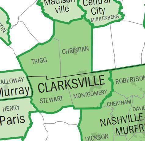
The Clarksville Metropolitan Statistical Area is defined by the United States Census Bureau as an area consisting of four counties – two (Montgomery and Stewart) in Tennessee and two (Christian and Trigg) in Kentucky – anchored by the city of Clarksville, Tennessee. A July 1, 2009 estimate placed the population at 268,546. As of 2009, the Clarksville Metropolitan Statistical Area is the 167th largest MSA in the United States.
Contents
- Counties
- Places with more than 100000 inhabitants
- Places with 25000 to 50000 inhabitants
- Places with 5000 to 25000 inhabitants
- Places with 1000 to 5000 inhabitants
- Places with fewer than 1000 inhabitants
- Unincorporated places
- Demographics
- References
Prior to 2003, the area was officially known as the Clarksville-Hopkinsville Metropolitan Statistical Area and included only Montgomery and Christian counties. In 2003, Hopkinsville was removed from the official name as it was no longer considered a principal city. That year, Stewart and Trigg counties were also added to the MSA.
Counties
Places with more than 100,000 inhabitants
Places with 25,000 to 50,000 inhabitants
Places with 5,000 to 25,000 inhabitants
Places with 1,000 to 5,000 inhabitants
Places with fewer than 1,000 inhabitants
Unincorporated places
Demographics
As of the census of 2000, there were 232,000 people, 83,332 households, and 61,719 families residing within the MSA. The racial makeup of the MSA was 74.16% White, 19.13% African American, 0.51% Native American, 1.43% Asian, 0.23% Pacific Islander, 1.98% from other races, and 2.55% from two or more races. Hispanic or Latino of any race were 4.61% of the population.
The median income for a household in the MSA was $33,869, and the median income for a family was $39,451. Males had a median income of $29,506 versus $21,849 for females. The per capita income for the MSA was $16,341.