
Website mcgtn.org Founded 1818 | Largest city Clarksville Area 1,409 km² Population 184,119 (2013) Unemployment rate 5.3% (Apr 2015) | |
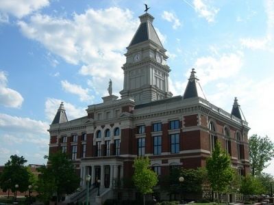 | ||
Colleges and Universities Austin Peay State University, Queen City College, North Central Institute, Miller‑Motte Technical College‑Clarksville, Daymar Institute | ||
Montgomery County is a county located in the U.S. state of Tennessee. As of the 2010 census, the population was 172,331. The county seat is Clarksville. The county was created in 1836.
Contents
- Map of Montgomery County TN USA
- History
- Geography
- Dunbar Cave
- Adjacent counties
- State protected areas
- Demographics
- Government
- Elected officials
- City
- References
Map of Montgomery County, TN, USA
Montgomery County is included in the Clarksville, TN–KY Metropolitan Statistical Area.
History
The county was named for John Montgomery, a soldier in the American Revolutionary War and an early settler who founded the city of Clarksville. It was formed when Tennessee County, North Carolina, was split in 1796, when Tennessee became a state, to reduce confusion. The same year, much of the eastern portion of the county was combined with land taken from Sumner County to form Robertson County. Later acts of the Tennessee General Assembly further reduced the county to its current size and boundaries by 1871.
Montgomery County was the site of several early saltpeter mines. Saltpeter is the main ingredient of gunpowder and was obtained by leaching the earth from several local caves. Bellamy Cave, located near Stringtown, still contains the remains of two dozen saltpeter leaching vats and apparently was a large operation. Cooper Creek Cave also shows evidence of extensive mining and contains the remains of "many saltpeter hoppers". Both were probably mined during the War of 1812. Dunbar Cave is reported to have been mined for saltpeter during the Mexican War, but commercial development has destroyed any evidence of this. Little mining is likely to have happened here during the Civil War, since the Union Army captured this part of Tennessee in early 1862.
Geography
According to the U.S. Census Bureau, the county has a total area of 544 square miles (1,410 km2), of which 539 square miles (1,400 km2) is land and 4.7 square miles (12 km2) (0.9%) is water.
Dunbar Cave
Montgomery County lies in a region of well-developed karst topography and has a cave system named Dunbar Cave. Dunbar Cave is the centerpiece of Dunbar Cave State Park, which encompasses approximately 110 acres and is one of the most visited units in the Tennessee State Park System.
Dunbar Cave was explored by prehistoric Indians. Remains of their cane torches have been found in the cave and archaeologists have excavated numerous artifacts inside the entrance. During a research trip into the cave on January 15, 2005, Park Ranger Amy Wallace, History Professor Joe Douglas, local historian Billyfrank Morrison, and Geologist Larry E. Matthews, discovered Indian Glyphs on the walls of the cave. Subsequent investigations by archaeologists from the University of Tennessee at Knoxville confirmed that these drawings were left by Mississippian-era Indians. These Indian Glyphs were featured on the tour of the cave. However, in 2009 the cave was closed due to the presence of White Nose Syndrome detected in one single bat. The above ground portion of the Park is still open to the public.
Adjacent counties
State protected areas
Demographics
As of the census of 2000, there were 134,768 people, 48,330 households, and 35,957 families residing in the county. The population density was 250 people per square mile (96/km²). There were 52,167 housing units at an average density of 97 per square mile (37/km²). The racial makeup of the county was 73.17% White, 19.18% Black or African American, 0.53% Native American, 1.82% Asian, 0.21% Pacific Islander, 2.18% from other races, and 2.91% from two or more races. 5.16% of the population were Hispanic or Latino of any race.
There were 48,330 households out of which 40.70% had children under the age of 18 living with them, 58.70% were married couples living together, 12.20% had a female householder with no husband present, and 25.60% were non-families. 20.20% of all households were made up of individuals and 5.50% had someone living alone who was 65 years of age or older. The average household size was 2.70 and the average family size was 3.11.
In the county, the population was spread out with 28.40% under the age of 18, 12.30% from 18 to 24, 34.30% from 25 to 44, 17.20% from 45 to 64, and 7.80% who were 65 years of age or older. The median age was 30 years. For every 100 females there were 101.20 males. For every 100 females age 18 and over, there were 98.80 males.
The median income for a household in the county was $38,981, and the median income for a family was $43,023. Males had a median income of $30,696 versus $22,581 for females. The per capita income for the county was $17,265. About 7.90% of families and 10.00% of the population were below the poverty line, including 12.70% of those under age 18 and 10.70% of those age 65 or over.
Government
The County Commission has 21 members, each elected from a single-member district. In addition, voters elect a County Mayor at-large and certain other county-level positions, including the sheriff.