
Phone +1 888-327-2757 | ||
 | ||
Hours Open today · 5AM–10PMMonday5AM–10PMTuesday5AM–10PMWednesday5AM–10PMThursday5AM–10PMFriday5AM–10PMSaturday5AM–10PMSunday5AM–10PM Similar East Bay Regional Park Distr, Berkeley Hills, Tilden Regional Park, Huckleberry Botanic Regional, Garber Park | ||
Claremont Canyon Regional Preserve is a small regional park mainly located in the city of Oakland, California, and administered by the East Bay Regional Park District. The park is named for the canyon in which it's situated, Claremont Canyon, out of which Claremont Creek flows on its way to its confluence with Temescal Creek. Originally, the canyon was named "Harwood's Canyon", then "Telegraph Canyon". The name was changed to Claremont by a developer of the nearby Claremont district.
Contents
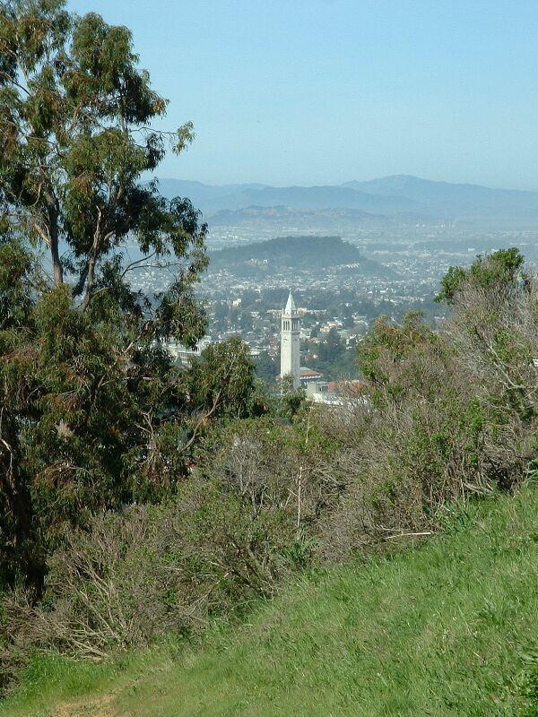
Despite its small size of 205 acres (83 ha), Claremont Canyon Regional Preserve forms an important link in the chain of parks that line the Berkeley Hills. It rises from a height of about 420 ft (130 m) above sea level, just behind the Clark Kerr campus of the University of California, Berkeley to the average 1300 ft (400 m) ridge of the East Bay hills, linking by way of other conserved land belonging to the University and the East Bay Municipal Utility District to other parks such as Tilden Regional Park and Sibley Volcanic Regional Preserve. It thus offers direct pedestrian access to the park system, with connections to public transportation, from the lower-lying residential areas of Berkeley and Oakland.
Claremont canyon regional preserve panorama
Stonewall Panoramic TrailEdit
The Stonewall Panoramic Trail begins at a parking area on Stonewall Road, behind the historic Claremont Hotel. The trail is 1.6 miles (2.6 km) long and ascends 700 feet (210 m). The steep path up to the ridge gives splendid views across the cities of Berkeley and Oakland, and beyond to San Francisco Bay, the Golden Gate Bridge and San Francisco. On clear days, especially in winter, the Farallon Islands, about 44 miles (70 km) away, can be seen beyond the Golden Gate.
Within the Preserve is a side canyon called Gwin Canyon with a 2-mile (3.2 km) trail accessible from the end of Norfolk Road near Strathmoor Drive in the Oakland Hills.
While the upper reaches of Claremont Canyon are technically outside the Preserve, there are an additional 225 acres (0.91 km2) of open space contiguous to it owned and managed by the University of California. A local non-profit citizens' organization, the Claremont Canyon Conservancy, works with the public landowners offering stewardship services and educational programs.