
Elevation 2,927 m | ||
 | ||
Similar Caïres de Cougourde, Cima di Brocan, Cime du Gélas, Cime de la Malédie, Monte Clapier | ||
Randonn e cime de l agnel 04 08 2013
Cime de l'Agnel is a mountain. It is one of the main peaks of the Mercantour-Argentera, upstream of Upper Boréon in the Vésubie, at the border between the Alpes-Maritimes and Piedmont.
Contents
- Randonn e cime de l agnel 04 08 2013
- Map of Cime de lAgnel 06450 Saint Martin VC3A9subie France
- Cime de l agnel 2927m
- References
Map of Cime de l'Agnel, 06450 Saint-Martin-V%C3%A9subie, France
It is surrounded by the peaks of the Caïres de Cougourde, the Malaribe and the Caïre de l'Agnel. Its summit is easily reached by hiking from the Cougourde hut (2 hours). It is also a classic peak in winter and spring for backcountry skiers.
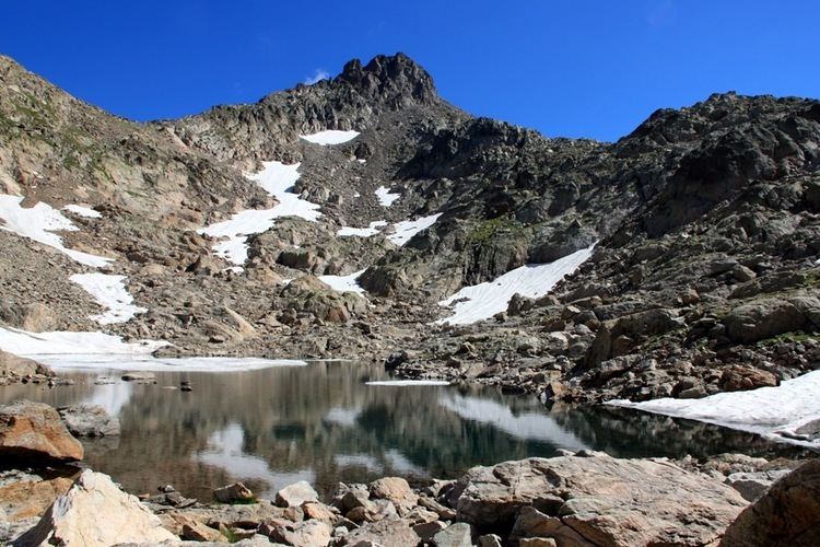
On the southwest side of the Agnel peak is the Lake of the Agnel (2645 m). The latter should not be confused with the Lakes of Agnel (2342 m and 2360 m), located on the route of GR5-GR56, close to the Pas de la Cavale in the Salso Moreno Valley, Tinée.
Cime de l agnel 2927m
References
Cime de l'Agnel Wikipedia(Text) CC BY-SA