
Time zone CET (UTC+1) | Area 1,033 km² | |
 | ||
Points of interest Destinations | ||
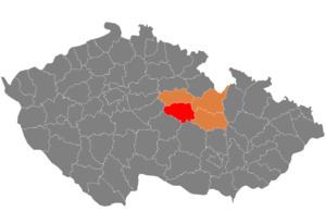
Chrudim District (Czech: Okres Chrudim) is a district (okres) within Pardubice Region (Pardubický kraj) of the Czech Republic. Its capital is city of Chrudim.
Contents
- Map of Chrudim District Czechia
- Overview
- Geography and agriculture
- Demography
- Employment
- Education
- Health service
- Complete list of municipalities
- References
Map of Chrudim District, Czechia
Overview
Area of Chrudim District is 1,030 km², it has 104 748 inhabitants. The district has mostly flat terrain with slopes of Iron Mountains (Železné hory) appearing on the south. Seč Dam (Sečská přehrada) is the largest water surface in region (2.2 km²), Chrudimka is the longest river in region (104 km). Industrial centres are Chrudim (mechanical engineering, textile, food industry), Hlinsko (electrotechnical, textile) and Skuteč (textile). Climatic conditions and terrain make the area convenient for agriculture.
Tourism is concentrated on Seč dam and historical architecture. Of note is historical centre of Chrudim, hippology museum in Slatiňany, castles Košumberk, Lichnice, Rychmburk and Oheb, war memorial in Ležáky and Skansen Veselý Kopec.
Among notable persons associated with the district are inventor Josef Ressel, composers Zdeněk Fibich and Vítězslav Novák, writers Karel Václav Rais and Jaroslav Vrchlický, painters Antonín Slavíček, Antonin Chittussi and Adolf Kosárek.
Geography and agriculture
As of December 31, 2003 the district area is 1,029.67 km², including:
Demography
As of June 30, 2005:
Employment
(2003)
Education
(2003)
Health service
(2003)
Complete list of municipalities
Cities are bolded.
Chrudim - Běstvina - Biskupice - Bítovany - Bojanov - Bor u Skutče - Bořice - Bousov - Bylany - Ctětín - Čankovice - České Lhotice - Dědová - Dolní Bezděkov - Dřenice - Dvakačovice - Hamry - Heřmanův Městec - Hlinsko - Hluboká - Hodonín - Holetín - Honbice - Horka - Horní Bradlo - Hošťalovice - Hrochův Týnec - Hroubovice - Chrast - Chroustovice - Jeníkov - Jenišovice - Kameničky - Kladno - Klešice - Kněžice - Kočí - Kostelec u Heřmanova Městce - Krásné - Krouna - Křižanovice - Lány - Leštinka - Libkov - Liboměřice - Licibořice - Lipovec - Lozice - Lukavice - Luže - Míčov-Sušice - Miřetice - Mladoňovice - Morašice - Mrákotín - Nabočany - Načešice - Nasavrky - Orel - Ostrov - Otradov - Perálec - Podhořany u Ronova - Pokřikov - Prachovice - Proseč - Prosetín - Předhradí - Přestavlky - Raná - Rabštejnská Lhota - Ronov nad Doubravou - Rosice - Rozhovice - Řestoky - Seč - Skuteč - Slatiňany - Smrček - Sobětuchy - Stolany - Střemošice - Studnice - Svídnice - Svratouch - Tisovec - Trhová Kamenice - Trojovice - Třemošnice - Třibřichy - Tuněchody - Úherčice - Úhřetice - Vápenný Podol - Včelákov - Vejvanovice - Vítanov - Vojtěchov - Vortová - Vrbatův Kostelec - Všeradov - Vysočina - Vyžice - Zaječice - Zájezdec - Zderaz - Žlebské Chvalovice - Žumberk