
Named for Pierre Chouteau, Jr. Congressional district At-large Website www.co.chouteau.mt.us Founded 1865 | Area 10,352 km² Population 5,849 (2013) University Stone Child College | |
 | ||
Points of interest Old Fort Benton, Museum of the Northern, Big Sandy Historical Museum, Highwood Mountains | ||
Chouteau County is a county located in the North-Central region of the U.S. state of Montana. As of the 2010 census, the population was 5,813. Its county seat is Fort Benton. The county was established in 1865 as one of the original nine counties of Montana, and named in 1882 after Pierre Chouteau, Jr., a fur trader who established a trading post that became Fort Benton, which was once an important port on the Missouri River.
Contents
- Map of Chouteau County MT USA
- Geography
- Major highway
- National protected areas
- 2000 census
- 2010 census
- Economy
- City
- Towns
- Census designated places
- Unincorporated communities
- References
Map of Chouteau County, MT, USA
Chouteau County is home to the Chippewa-Cree tribe on the Rocky Boy Indian Reservation. It contains part of the Lewis and Clark National Forest.
Geography
According to the U.S. Census Bureau, the county has a total area of 3,997 square miles (10,350 km2), of which 3,972 square miles (10,290 km2) is land and 24 square miles (62 km2) (0.6%) is water.
Chouteau County was once the largest county in the Montana Territory and the second largest in the United States, with an area of 15,439 square miles (39,990 km2) in the early 20th century. However, some parts of the county were over 250 miles (400 km) from Fort Benton, and in 1909 an agreement was reached to subdivide the county.
Chouteau County lost half of its population from 1910 to 1930.
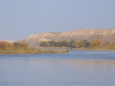
The land is mostly prairie. The Bear Paw Mountains rise in the eastern section and the Little Rockies and the Highwood ranges are in the southern portion. Major rivers include the Teton River, Marias River, Missouri River and the Arrow River.
Major highway
National protected areas
2000 census
As of the census of 2000, there were 5,970 people, 2,226 households, and 1,613 families residing in the county. The population density was 2 people per square mile (1/km²). There were 2,776 housing units at an average density of <1/km² (1/sq mi). The racial makeup of the county was 84.00% White, 0.08% Black or African American, 14.62% Native American, 0.23% Asian, 0.10% Pacific Islander, 0.23% from other races, and 0.72% from two or more races. 0.67% of the population were Hispanic or Latino of any race. 23.9% were of German, 11.7% Norwegian, 8.2% English and 7.3% Irish ancestry. 96.0% spoke English, 2.5% Cree and 1.0% Spanish as their first language.
There were 2,226 households out of which 34.00% had children under the age of 18 living with them, 60.90% were married couples living together, 8.40% had a female householder with no husband present, and 27.50% were non-families. 24.90% of all households were made up of individuals and 10.60% had someone living alone who was 65 years of age or older. The average household size was 2.59 and the average family size was 3.11.
In the county, the population was spread out with 28.80% under the age of 18, 6.50% from 18 to 24, 24.10% from 25 to 44, 23.10% from 45 to 64, and 17.50% who were 65 years of age or older. The median age was 39 years. For every 100 females there were 100.80 males. For every 100 females age 18 and over, there were 97.10 males.
The median income for a household in the county was $29,150, and the median income for a family was $32,399. Males had a median income of $22,080 versus $19,318 for females. The per capita income for the county was $14,851. About 16.50% of families and 20.50% of the population were below the poverty line, including 29.30% of those under age 18 and 8.40% of those age 65 or over.
2010 census
As of the 2010 United States Census, there were 5,813 people, 2,294 households, and 1,560 families residing in the county. The population density was 1.5 inhabitants per square mile (0.58/km2). There were 2,879 housing units at an average density of 0.7 per square mile (0.27/km2). The racial makeup of the county was 75.8% white, 21.8% American Indian, 0.4% Asian, 0.1% Pacific islander, 0.1% black or African American, 0.3% from other races, and 1.6% from two or more races. Those of Hispanic or Latino origin made up 1.6% of the population. In terms of ancestry, 27.6% were German, 13.0% were Irish, 11.2% were English, 9.8% were Norwegian, and 2.0% were American.
Of the 2,294 households, 31.2% had children under the age of 18 living with them, 52.3% were married couples living together, 10.1% had a female householder with no husband present, 32.0% were non-families, and 29.1% of all households were made up of individuals. The average household size was 2.48 and the average family size was 3.04. The median age was 41.5 years.
The median income for a household in the county was $41,064 and the median income for a family was $50,201. Males had a median income of $33,866 versus $25,077 for females. The per capita income for the county was $20,202. About 14.8% of families and 21.0% of the population were below the poverty line, including 33.6% of those under age 18 and 6.2% of those age 65 or over.
Economy
Chouteau County is the largest winter wheat producer for the state of Montana. They are located in the heart of the "Golden Triangle", an area which produces about 45% of Montana's wheat crop each year.