
Time zone GMT +5 (UTC+5) Founded 1992 Local time Monday 6:58 AM | Area 4,857 km² Population 25,039 (2009) | |
 | ||
Weather -10°C, Wind W at 5 km/h, 71% Humidity | ||
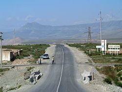
Dubsamash big alay
Chong-Alay District (big Alay) (Kyrgyz: Чоң Алай району; Russian: Чон-Алайский район) is a raion (district) of Osh Region in far south-western Kyrgyzstan. The capital lies at Daroot-Korgon. Its area is 4,857 square kilometres (1,875 sq mi), and its resident population was 25,039 in 2009. The Chong-Alay District include 3 rural communities (ayıl ökmötü): Chong-Alay, Kashka-Suu, and Jekendi.
Contents
- Dubsamash big alay
- Map of Chong Alay District Kyrgyzstan
- Geography
- Demographics
- Ethnic composition
- Populated places
- References
Map of Chong-Alay District, Kyrgyzstan
Geography
Chong-Alay District occupies the western part of Alay Valley. The northern boundary of the district is located at Alay Mountains, and southern - at Trans-Alay Range. The valley is inclined from east to west, with the lowest point at 1560 meters above sea level.
Climate is sharply continental with cold winters. Annual precipitation is 500–650 mm. Average temperature in July is +19-22C, and December -10-15C.
The hydrology is dominated by the river Kyzyl-Suu (flowing towards the west) and its tributaries.
Demographics
As of 2009, Chong-Alay District comprised 21 villages. All people live in rural areas.
Ethnic composition
According to the 2009 Census, the ethnic composition of the Chong-Alay District (de jure population) was:
Populated places
The populated places in the Chong-Alay District are:
- Jekendi aiyl okmotu (Karamyk, Jekendi, Kara-Teyit, Shibee, and Chuluk)
- Kashka-Suu aiyl okmotu (Kashka-Suu, Achyk-Suu, Kabyk, Kara-Kabak, and Burgan-Suu)
- Chong-Alay aiyl okmotu (Daroot-Korgon, Jash-Bashy, Jashtilek, Jaman-Jar, Kochkorchu, Kulchu, Kyzyl-Tuu, Sary-Bulak, Chak, Kyzyl-Eshme, and Kara-Shybak)