
Country Colombia Founded never Demonym(s) Chiquinquireño Population 72,274 (2015) | Elevation 2,556 m (8,386 ft) Area 133 km² Local time Sunday 10:27 AM | |
 | ||
Time zone Colombia Standard Time (UTC-5) Weather 16°C, Wind NE at 6 km/h, 62% Humidity Points of interest Basilica Chiquinquira, Catedral Sagrado Corazón, Pozo De La Virgen, Iglesia de la Renovación, Museo de Arte Religioso | ||
Chiquinquirá is a town and municipality in the Colombian Department of Boyacá, part of the subregion of the Western Boyacá Province. Located some 115 km north of Bogotá, Chiquinquirá is 2,556 metres (8,386 ft) above sea level and has a yearly average temperature 58 °F (14 °C)
Contents
- Map of ChiquinquirC3A1 BoyacC3A1 Colombia
- Chiquinquira Boyac
- Etymology
- Geography and religion
- History
- References
Map of Chiquinquir%C3%A1, Boyac%C3%A1, Colombia
Chiquinquira, Boyacá
Etymology
The name Chiquinquirá comes from Chibcha and means "Place of swamps covered with fog".
Geography and religion
Chiquinquirá is constituted by two zones: the urban zone or town which is formed by approximately 40 neighbourhoods between the strata 1 and 4, and the rural zone which is divided in 17 sub zones located around the city.
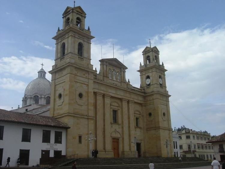
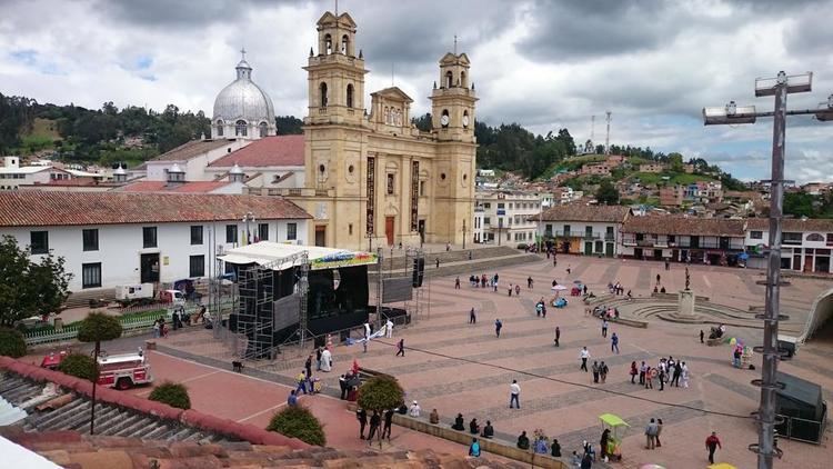
It is home to the Basílica de Chiquinquirá, which houses the image of the Virgen de Chiquinquirá, the patroness saint of Colombia. Chiquinquirá is a major point of religious pilgrimage (source: Colombia Lonely Planet Guide, 2nd Edition, 1995).
History
The area of Chiquinquirá used to be inhabited by the Muisca before the Spanish conquest and Chiquiquinrá was an important place in the Chiquinquirá Valley. It was ruled by an independent cacique within the Muisca Confederation. It was never properly founded as a Municipality.