
Settled 1827 Postal Code N0N 1J1 | County Lambton Time zone EST (UTC-5) Population 936 (2011) Local time Sunday 10:13 AM | |
 | ||
First Nation Chippewas of Kettle and Stony Point Weather -4°C, Wind SE at 29 km/h, 70% Humidity | ||
Kettle Point 44 is an Indian reserve 35 kilometres (22 mi) northeast of Sarnia, Ontario, Canada, on the southern shore of Lake Huron. The reserve serves as the land base for the Chippewas of Kettle and Stony Point First Nations. There are two nations on this reserve, Chippewas of Kettle Point, and Chippewas of Stony Point. Its area is 895.7 ha.
Contents
Map of Kettle Point, ON, Canada
They are two of 42 Anishinaabeg First Nations in Ontario, and belongs to the Union of Ontario Indians.
History
The Chippewa (also generally called Ojibwe in Canada) are an Anishinaabe-speaking indigenous nation with people within the borders of present-day Canada and the United States.
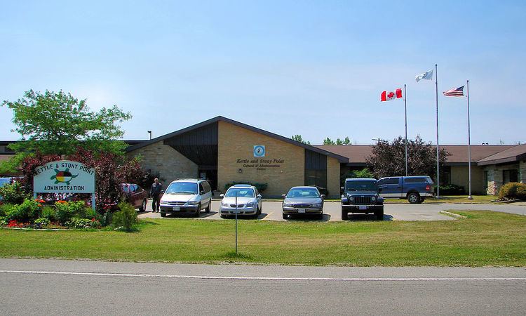
Governance
Former Chiefs of the Band
Traditional Chiefs: Oshawnoo at Kettle Point (1826), Whapagas at Stony Point (1826), John Johnston (1860), Isaac Shawnoo (1860).
Chief Councilors representing K&SP at the "General Council at Sarnia": John Johnston (1872), Isaac Shawnoo (1872), Lewis Cloud (1892), Adam Sapah (1895), Jeffrey Bressette (1899), James Johnston (1899), John Elijah (1907), John Milliken (1907), Caleb Shawkence (1913)
Elected Chiefs since Independence': Cornelius Shawnoo (1919), John Milliken (1907), Sam Bressette (1928–34), Caleb Shawkence (1934-40), Frank Bressette (1940), Bruce Milliken (1943), Frank Bressette (1946), Wilfred Shawkence (1949), Frank Bressette (1952), Earl Bressette (1954), David Bressette (1956), Thomas Bressette (1958-1970), Charles Shawkence (1970-1976), Frederick F. Bressette (1976), Charles Shawkence (1978-1981), Victor H. George (1981), Milton L. George (1982), Charles Shawkence (1984-1988), Yvonne Bressette (1988), Thomas M. Bressette (1990–97), Irving George (1997-98), Norm Shawnoo (1998-2000), Thomas M. Bressette (2000-2008), Elizabeth Cloud (2008-2012), Thomas M. Bressette (2012-2016)
Land dispute
In 1942 during World War II, the federal government appropriated land at Stoney Point under the War Measures Act to build a military camp, Camp Ipperwash, after offering payment to the Chippewa of Kettle and Stony Point First Nations. Their offer was rejected. The government had originally made as part of the offer a promise to return the land, but continued to use it after the war, by the 1990s primarily as a summer training camp for cadets. Residents were evicted, and moved into the Kettle Point First Nation, with unhappy consequences and social tension.
In the 1990s, during rising political activism, band members of the Stony Point First Nation began occupying parts of the base in 1993. The military withdrew entirely in 1995. On Labour Day 1995, Band members barricaded part of neighboring Ipperwash Provincial Park to promote their land claim. They said they were protecting a native burial ground and water purification plant. During a confrontation with Ontario Provincial Police at the protest, an Ojibwe band member, Dudley George, was shot and killed.
In 1997, acting Sgt. Kenneth Deane was convicted of criminal negligence causing George's death. Native groups called for an official inquiry into George's death, but none was launched until the provincial government changed in 2003. The Ipperwash Inquiry began in 2004 and concluded in 2006. Commissioner Sidney B. Linden delivered his report in 2007.
An Agreement in Principle, dated 1998, was never officially accepted by the First Nation, and the claim is still outstanding as of 2007. Ontario officially returned the land to the First Nation in 2009, but they will govern it together for some time, in order to manage environmental and other issues. In 2015 a $90 million land claim was settled and paid to both First Nations involved.
The Investigation Agreement to determine the environmental impacts of the military base on the land began in 2006. The investigation will provide the basis for environmental amelioration, if necessary. In addition, Cultural, Environmental and UXO investigations are underway. Canada along with the First Nation are working closely with an independent contractor selected through the Public Works Canada-tendering process, as well as with special advisors with the necessary expertise to oversee the project. The cleanup may prove difficult, since the base was used as a firing range for tanks. Unexploded ordnance has been found.
Demographics
In May 2008, the resident population was 1260, of whom about 900 members lived off the reserve. As of January 2011, the band had a total of 2219 registered members, of whom 1300 live on their own reserve, 20 live on another reserve, and 899 don't live on a reserve. By July 2012, the number of registered members had increased to 2337, of whom 1316 live on the reserve.
Geology
Kettle Point is the site of a rare outcrop of an Upper Devonian shale called the Kettle Point Formation. This rock layer is exposed at the tip of the point near the shore of Lake Huron. A fragmentary fossil Dunkleosteus, named D. amblyodoratus or "blunt spear," was found there. Spherical or ovoid concretions of rock, locally called 'kettles', weather out of the shale along the shoreline. To the local Anishinabek, the rare stones were Thunderbird eggs. The concretions are now protected, but are often found on nearby properties.
Just off shore, below the Kettle Point formation, is a layer of the Hamilton Group of shales and limestones which contains a large amount of light-coloured, high-quality chert. In stone tool technology, it is a highly prized resource. When lake levels were lower, during the retreat of the Wisconsinian ice sheets, the chert was exposed and could be mined. This made the region a site of human occupation for at least 10,000 years. Kettle Point chert was dispersed to the far reaches of the region as projectile points, scrapers, and other tools.