
Orogeny Alpine orogeny Type of rock Sedimentary rock | Elevation 1,961 m (6,434 ft) Age of rock Mesozoic and Cenozoic | |
 | ||
Mountains Similar Alps, Kampenwand, Hochfelln, Sonntagshorn, Hochgern | ||
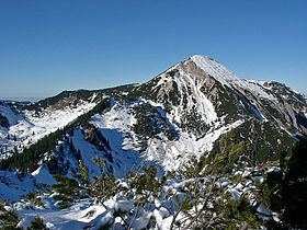
The Chiemgau Alps (German: Chiemgauer Alpen) are a mountain range in the Northern Limestone Alps and therefore belong to the Eastern Alps. Their major part is situated in Bavaria, Germany and only a small section crosses the Austrian border into the states of Salzburg and Tirol. They reach their highest elevation (1961 m) in the Sonntagshorn, a peak straddling the German-Austrian border.
Contents
Map of Chiemgau Alps, 83324 Ruhpolding, Germany
GeographyEdit
The Chiemgau Alps stretch from the Inn River in the West to the Salzach River in the East and cover a distance of 60 km in strike direction; their maximum width in North-South direction amounts to about 25–30 km. They are surrounded by the following mountain ranges:
Their northern edge often drops off quite drastically to the foothills.
Major peaksEdit
Peaks for rock climbing: