
Founded 1851 Area 1,310 km² | Congressional district 4th Website www.chickasawcoia.org Population 12,321 (2013) Unemployment rate 4.8% (Apr 2015) | |
 | ||
Rivers Cedar River, Wapsipinicon River, Elk Creek, Beaver Creek Points of interest The Little Brown Church, Mikkelson Park, Cedar View Park, Bradford Pioneer Village, Hawkeye Buffalo Ranch | ||
Chickasaw County is a county located in the U.S. state of Iowa. As of the 2010 census, the population was 12,439. Its county seat is New Hampton. The county was named for the southern Indian Nation whose chief was Bradford.
Contents
- Map of Chickasaw County IA USA
- History
- Geography
- Major highways
- Adjacent counties
- 2010 census
- 2000 census
- Population ranking
- References
Map of Chickasaw County, IA, USA
History
Chickasaw County was founded on January 15, 1851. It was named after the Chickasaw tribe, which lived in the Southern United States at the time.
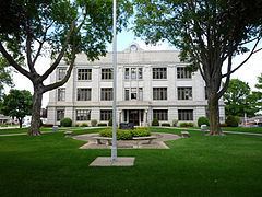
The first white settlers came in 1848 and the first county seat was from 1854 in Bradford, in the southwestern corner of the county. In the spring of 1857, the seat was moved to New Hampton, located near the geographic center, and was then called Chickasaw Center. The first offices needed of the county government were housed in private houses and the school building. In 1865, the first courthouse was erected, which was expanded in 1876, and completely destroyed by a fire on March 26, 1880.
Geography
According to the U.S. Census Bureau, the county has a total area of 506 square miles (1,310 km2), of which 504 square miles (1,310 km2) is land and 1.3 square miles (3.4 km2) (0.3%) is water.
Major highways
Adjacent counties
2010 census
The 2010 census recorded a population of 12,439 in the county, with a population density of 24.632/sq mi (9.510/km2). There were 5,679 housing units, of which 5,204 were occupied.
2000 census
As of the census of 2000, there were 13,095 people, 5,192 households, and 3,644 families residing in the county. The population density was 26 people per square mile (10/km²). There were 5,593 housing units at an average density of 11 per square mile (4/km²). The racial makeup of the county was 98.75% White, 0.05% Black or African American, 0.03% Native American, 0.27% Asian, 0.01% Pacific Islander, 0.29% from other races, and 0.60% from two or more races. 0.63% of the population were Hispanic or Latino of any race.
There were 5,192 households out of which 31.90% had children under the age of 18 living with them, 60.70% were married couples living together, 6.30% had a female householder with no husband present, and 29.80% were non-families. 26.10% of all households were made up of individuals and 13.70% had someone living alone who was 65 years of age or older. The average household size was 2.48 and the average family size was 3.00.
In the county, the population was spread out with 26.10% under the age of 18, 6.90% from 18 to 24, 25.60% from 25 to 44, 23.40% from 45 to 64, and 17.90% who were 65 years of age or older. The median age was 40 years. For every 100 females there were 100.10 males. For every 100 females age 18 and over, there were 96.50 males.
The median income for a household in the county was $37,649, and the median income for a family was $44,306. Males had a median income of $30,099 versus $21,309 for females. The per capita income for the county was $18,237. About 5.90% of families and 8.30% of the population were below the poverty line, including 9.90% of those under age 18 and 7.70% of those age 65 or over.
Chickasaw County posted the highest county unemployment rate in Iowa in the 2000 Census with 8% of the workforce unemployed. This figure, however, was still relatively low compared to the problems faced by many other counties in the Midwest.
Population ranking
The population ranking of the following table is based on the 2010 census of Chickasaw County.
† county seat