
ZIP codes 50659, 50661 Area 8.18 km² Population 3,568 (2013) Area code 641 | Time zone Central (CST) (UTC-6) FIPS code 19-56100 Elevation 353 m Local time Saturday 6:17 AM | |
 | ||
Weather 2°C, Wind NE at 32 km/h, 99% Humidity | ||
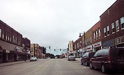
New Hampton is a city in, and the county seat of, Chickasaw County, Iowa, United States. The population was 3,571 at the 2010 census.
Contents
Map of New Hampton, IA 50659, USA
History
New Hampton was founded about 1855. It is named after a New Hampton in New England, the native town of one of its founders.
Geography
New Hampton is located at 43°3′35″N 92°18′53″W (43.059701, -92.314703).
According to the United States Census Bureau, the city has a total area of 3.16 square miles (8.18 km2), all of it land.
2010 census
As of the 2010 census, there were 3,571 people, 1,555 households, and 943 families residing in the city. The population density was 1,130.1 inhabitants per square mile (436.3/km2). There were 1,697 housing units at an average density of 537.0 per square mile (207.3/km2). The racial makeup of the city was 96.0% White, 0.3% African American, 0.1% Native American, 0.5% Asian, 2.5% from other races, and 0.4% from two or more races. Hispanic or Latino of any race were 3.9% of the population.
There were 1,555 households of which 26.5% had children under the age of 18 living with them, 48.4% were married couples living together, 8.1% had a female householder with no husband present, 4.1% had a male householder with no wife present, and 39.4% were non-families. 34.5% of all households were made up of individuals and 16.7% had someone living alone who was 65 years of age or older. The average household size was 2.20 and the average family size was 2.82.
The median age in the city was 44.8 years. 22.9% of residents were under the age of 18; 6.7% were between the ages of 18 and 24; 20.6% were from 25 to 44; 26.8% were from 45 to 64; and 23% were 65 years of age or older. The gender makeup of the city was 47.4% male and 52.6% female.
2000 census
As of the 2000 census, there were 3,692 people, 1,545 households, and 976 families residing in the city. The population density was 1,274.0 people per square mile (491.5/km²). There were 1,658 housing units at an average density of 572.1 per square mile (220.7/km²). The racial makeup of the city was 98.62% White, 0.03% Native American, 0.46% Asian, 0.03% Pacific Islander, 0.08% from other races, and 0.79% from two or more races. Hispanic or Latino of any race were 0.35% of the population.
There were 1,545 households out of which 29.3% had children under the age of 18 living with them, 53.9% were married couples living together, 7.4% had a female householder with no husband present, and 36.8% were non-families. 33.5% of all households were made up of individuals and 18.4% had someone living alone who was 65 years of age or older. The average household size was 2.28 and the average family size was 2.93.
Age spread: 23.1% under the age of 18, 7.3% from 18 to 24, 25.2% from 25 to 44, 21.6% from 45 to 64, and 22.8% who were 65 years of age or older. The median age was 41 years. For every 100 females there were 90.9 males. For every 100 females age 18 and over, there were 82.5 males.
The median income for a household in the city was $40,082, and the median income for a family was $50,360. Males had a median income of $33,125 versus $21,217 for females. The per capita income for the city was $20,255. About 3.9% of families and 6.1% of the population were below the poverty line, including 6.0% of those under age 18 and 6.1% of those age 65 or over.