
Named for William Orlando Butler Area 1,507 km² Population 15,021 (2013) | Website www.butlercoiowa.org Founded 1851 | |
 | ||
Rivers Shell Rock River, West Fork Cedar River, Beaver Creek | ||
Butler County is a county located in the U.S. state of Iowa. As of the 2010 census, the population was 14,867. Its county seat is Allison. The county was organized in 1854 and named for General William O. Butler.
Contents
- Map of Butler County IA USA
- History
- Geography
- Major highways
- 2010 census
- 2000 census
- Unincorporated communities
- Townships
- Population ranking
- References
Map of Butler County, IA, USA
History
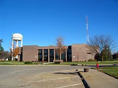
Butler County was formed on January 15, 1851 from open land. It was named after Kentucky native William Orlando Butler, a general and hero of the Mexican–American War, who ran as Vice President of the United States in 1848. Until 1854, the county was governed by other counties. Only at this time did it have enough inhabitants to establish its own local government. The first court proceedings were conducted in a small log cabin of a settler. In 1858, the first courthouse was completed in Clarksville. After it was sold shortly thereafter to the local school district, it was used as a schoolhouse from 1863 until 1903.
Clarksville was the first county seat, from 1854 to 1860, after which Butler Center became the seat. Because locals became disenchanted with Butler Center (partially because of its inaccessibility during the winter), Allison was made the county seat on January 10, 1881.
When the tracks of the Dubuque and Dakota Railroad were laid through Allison, the seat was moved there on January 10, 1881. Allison was named after the Dubuque native Republican politician, lawyer and senator William B. Allison.
Butler County is the only county in Iowa that does not have any stop lights, a hospital, or a movie theatre. There are also no national fast food chains in Butler county.
Geography
According to the U.S. Census Bureau, the county has a total area of 582 square miles (1,510 km2), of which 580 square miles (1,500 km2) is land and 1.6 square miles (4.1 km2) (0.3%) is water.
Major highways
2010 census
The 2010 census recorded a population of 14,867 in the county, with a population density of 25.63/sq mi (9.90/km2). There were 6,682 housing units, of which 6,120 were occupied.
2000 census
As of the census of 2000, there were 15,305 people, 6,175 households, and 4,470 families residing in the county. The population density was 26 people per square mile (10/km²). There were 6,578 housing units at an average density of 11 per square mile (4/km²). The racial makeup of the county was 98.95% White, 0.08% Black or African American, 0.05% Native American, 0.20% Asian, 0.02% Pacific Islander, 0.16% from other races, and 0.53% from two or more races. 0.58% of the population were Hispanic or Latino of any race.
There were 6,175 households out of which 30.90% had children under the age of 18 living with them, 62.80% were married couples living together, 6.30% had a female householder with no husband present, and 27.60% were non-families. 25.00% of all households were made up of individuals and 14.50% had someone living alone who was 65 years of age or older. The average household size was 2.43 and the average family size was 2.90.
In the county, the population was spread out with 24.40% under the age of 18, 6.40% from 18 to 24, 24.90% from 25 to 44, 24.20% from 45 to 64, and 20.10% who were 65 years of age or older. The median age was 41 years. For every 100 females there were 96.20 males. For every 100 females age 18 and over, there were 93.70 males.
The median income for a household in the county was $35,883, and the median income for a family was $42,209. Males had a median income of $30,356 versus $20,864 for females. The per capita income for the county was $17,036. About 6.50% of families and 8.00% of the population were below the poverty line, including 9.80% of those under age 18 and 9.40% of those age 65 or over.
Unincorporated communities
Townships
Butler County is divided into sixteen townships:
Population ranking
The population ranking of the following table is based on the 2010 census of Butler County.
† county seat