
Country United States County Essex FIPS code 36-15330 Elevation 205 m Local time Saturday 7:23 AM | State New York Time zone Eastern (EST) (UTC-5) GNIS feature ID 0978824 Population 2,445 (2010) | |
 | ||
Weather -14°C, Wind NW at 19 km/h, 60% Humidity Area 273 km² (204.6 km² Land / 68.12 km² Water) Points of interest Lake Champlain, AuSable Chasm Bridge, North Star Underground Railroad, Poke‑O‑Moonshine Mountain, Bitch Mountain | ||
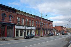
Chesterfield is a town in Essex County, New York, United States. The population was 2,445 at the 2010 census. The name possibly is from a location in New England.
Contents
- Map of Chesterfield NY USA
- History
- Geography
- Demographics
- Communities and inhabited locations
- Geographical and similar locations
- References
Map of Chesterfield, NY, USA
Chesterfield is in the northeasternmost part of the county and is 13 miles (21 km) west of Burlington, Vermont (by ferry), 16 mi (26 km) south of Plattsburgh, 77 mi (124 km) south of Montreal, Quebec, and 144 mi (232 km) north of Albany.
Much of the town is inside the Adirondack Park.
History
The town was inhabited by various Algonquian groups before the incursion of settlers.
The town was formed in 1802 from part of the town of Willsboro. The early settlers were from the New England area. An ice storm in 1998 damaged the town and the surrounding area.
Poke-O-Moonshine Mountain Fire Observation Station was added to the National Register of Historic Places in 2001.
Geography
According to the United States Census Bureau, the town has a total area of 105.4 square miles (272.9 km2), of which 79.0 sq mi (204.7 km2) is land and 26.3 sq mi (68.2 km2), or 24.99%, is water.
The north town line is the border of Clinton County, and the eastern town line is marked by Lake Champlain and Vermont.
The Ausable River forms the north town line.
Interstate 87, the Northway, is a major divided highway running north-south through Chesterfield. US Route 9 and New York State Route 22 are north-south highways adjacent to the Interstate.
Ferry service is seasonally available between Port Kent and Burlington, Vermont.
Demographics
As of the census of 2000, there were 2,409 people, 948 households, and 678 families residing in the town. The population density was 30.6 people per square mile (11.8/km²). There were 1,374 housing units at an average density of 17.4 per square mile (6.7/km²). The racial makeup of the town was 97.76% White, 0.25% African American, 0.21% Native American, 0.21% Asian, 0.58% from other races, and 1.00% from two or more races. Hispanic or Latino of any race were 0.87% of the population.
There were 948 households out of which 32.3% had children under the age of 18 living with them, 57.3% were married couples living together, 10.0% had a female householder with no husband present, and 28.4% were non-families. 21.1% of all households were made up of individuals and 9.2% had someone living alone who was 65 years of age or older. The average household size was 2.52 and the average family size was 2.93.
In the town, the population was spread out with 24.4% under the age of 18, 7.3% from 18 to 24, 28.8% from 25 to 44, 26.9% from 45 to 64, and 12.6% who were 65 years of age or older. The median age was 40 years. For every 100 females there were 95.7 males. For every 100 females age 18 and over, there were 94.8 males.
The median income for a household in the town was $39,875, and the median income for a family was $43,015. Males had a median income of $36,417 versus $25,156 for females. The per capita income for the town was $18,421. About 9.1% of families and 12.8% of the population were below the poverty line, including 19.5% of those under age 18 and 6.0% of those age 65 or over.