
State California Elevation 298 m Population 41,255 (2000) | County Los Angeles Time zone PST (UTC-8) Zip code 91311 Area code 818 | |
 | ||
Restaurants Los Toros Mexican Restaurant, Best Hikari Sushi, Fina Estampa, Les Sisters Southern Kitchen, Country Deli Hotels Staybridge Suites Chatsworth, Travelodge Chatsworth, Ramada Chatsworth, Radisson Hotel Chatswor, Hot Tomato | ||
Chatsworth is a neighborhood in the northwestern San Fernando Valley region of Los Angeles, California.
Contents
- Map of Chatsworth Los Angeles CA USA
- Population
- Geography
- Climate
- Native Americans
- Spain and Mexico
- United States
- Government and infrastructure
- Transportation
- Education
- Schools
- Public
- Private
- Parks and recreation
- Open space parks
- Neighborhood parks
- Chatsworth Reservoir
- Economy
- Notable people
- Cemetery
- References
Map of Chatsworth, Los Angeles, CA, USA
The area was home to Native Americans, some of whom left caves containing rock art. Chatsworth was explored and colonized by the Spanish beginning in the 18th Century. The land was part of a Mexican land grant in the 19th Century, and after the United States took over the land following the Mexican War, it was the largest such grant in California. Settlement and development followed.
Chatsworth has seven public and eight private schools. There are large open-space and smaller recreational parks as well as a public library and a transportation center. Distinctive features are the former Chatsworth Reservoir, the Santa Susana Field Laboratory and a number of private businesses.
Overall, Chatsworth has one of the lowest densities of any neighborhood in the city, and it has a relatively high income level.
Population
The 2000 U.S. census counted 35,073 residents in the 15.24-square-mile Chatsworth neighborhood—or 2,301 people per square mile, among the lowest population densities for both the city and the county. In 2008, the city estimated that the population had increased to 37,102. In 2000 the median age for residents was 40, considered old for city and county neighborhoods; the percentages of residents aged 35 and older were among the county's highest.
The neighborhood was considered "moderately diverse" ethnically within Los Angeles, with a relatively high percentage of whites and of Asian people. The breakdown was Whites, 65.7%; Latinos, 13.5%; Asians, 14.4%; Blacks, 2.2%; and others, 4.2%. Korea (10.4%) and the Philippines (9.3%) were the most common places of birth for the 25.2% of the residents who were born abroad—a low figure for Los Angeles.
The median yearly household income in 2008 dollars was $84,456, considered high for the city. The percentages of families that earned more than $40,000 was considered high for the county. Renters occupied 28.9% of the housing stock, and house- or apartment-owners held 71.1%. The average household size of 2.6 people was considered average for Los Angeles.
In 2000 there were 2,933 military veterans, or 10.8% of the population, a high percentage compared to the rest of the city. The percentages of married people were among the county's highest. The rate of 10% of families headed by single parents was low for the city.
Geography
Chatsworth is flanked by:
Climate
This region experiences hot and dry summers, with average daily high temperatures of 90–100 °F. According to the Köppen Climate Classification system, Chatsworth has a warm-summer Mediterranean climate, abbreviated "Csb" on climate maps.
Native Americans
Chatsworth was inhabited by the Tongva-Fernandeño, Chumash-Venturaño, and Tataviam-Fernandeño Native American tribes. Native American civilizations had inhabited the Valley for an estimated 8,000 years. Stoney Point is the site of the Tongva Native American settlement of Asha'awanga or Momonga, that was also a trading place with the neighboring Tataviam and Chumash people. The nearby Burro Flats Painted Cave remains a legacy of the Chumash culture's rock art and solstice ceremony spirituality.
Spain and Mexico
The first European explorers came into the Chatsworth area on August 5, 1769, led by the Spanish military leader Gaspar de Portolà. With its establishment in 1797 and subsequent Spanish Land Grant by the King of Spain, Mission San Fernando (Mission San Fernando Rey de España) gained dominion over the San Fernando Valley's lands, including future Chatsworth.
The Native American trail that had existed from the Tongva-Tatavium village called rancheria Santa Susana (Chatsworth) to another village, replaced by Mission San Fernando, became the route for missionaries and other Spanish travel up and down California. It was part of the El Camino del Santa Susana y Simi trail that connected the Valley's Mission, Los Angeles pueblo (town), and the southern missions with the Mission San Buenaventura, the Presidio of Monterey, and the northward missions. The trail crossed over the Santa Susana Pass to the Simi Valley, through present day city park Chatsworth Park South and the Santa Susana Pass State Historic Park. In 1795, the Spanish land grant had been issued for Rancho Simi, reconfirmed in 1842 by the Mexican governor. Its lands included part of current Chatsworth, westward from Andora Avenue.
In 1821, after the Mexican War of Independence from Spain, the Mission San Fernando became part of Alta California, Mexico. In 1834, the Mexican government began redistributing the mission lands. In 1846, the Mexican land grant for Rancho Ex-Mission San Fernando was issued by Governor Pío Pico. It was bounded on the north by Rancho San Francisco and the Santa Susana Mountains, on the west by the Simi Hills, on the east by Rancho Tujunga, and on the south by the Montañas de Portesuelo (Santa Monica Mountains). The Rancho Ex-Mission San Fernando received a Federal land patent to retain ownership by the United States Public Land Commission in 1873 and was the single largest land grant in California.
United States
In 1869, the grantee's son, Eulogio F. de Celis, returned from Spain to Los Angeles. In 1874, the family sold their northern half of Rancho Ex-Mission San Fernando to northern Californians, California State Senator Charles Maclay and his partners George K. Porter, a San Francisco shoe manufacturer, and his brother Benjamin F. Porter. The Porters’ land was west of present-day Sepulveda Boulevard including most of Chatsworth, and the Maclay land was east of Sepulveda Boulevard.
The Old Santa Susana Stage Road or Santa Susana Wagon Road continued in use as an alternative to the route along El Camino Viejo from 1861 to 1875, replacing the older road as the main route between Los Angeles and San Francisco. In 1876, the Southern Pacific Railroad opened a tunnel through the Newhall Pass, enabling rail connections from Los Angeles north to San Francisco, and rail travel soon replaced travel by stagecoach between Los Angeles and San Francisco. From this time, the stagecoach traffic to Santa Barbara once again used the coast route, and the Santa Susana Pass road was relegated to local traffic.
A new wagon route bypassing the deteriorating Devil's Slide was opened in 1895. Initially called El Camino Nuevo (the New Road), it was later named the Chatsworth Grade Road, which continued in use until Santa Susana Pass Road (now Old Santa Susana Pass Road) was built in 1917.
Government and infrastructure
The Chatsworth Branch Library, operated by the Los Angeles Public Library, is located at 21052 Devonshire Street. It was rebuilt in a modern style in 2002.
The Chatsworth Post Office, of the United States Postal Service, is located at 21606 Devonshire Street.
The U.S. Census Bureau operates the Los Angeles Regional Census Center in Chatsworth.
Transportation
The Chatsworth Transportation Center, a major transportation hub for the town and west valley, is served by 20 daily trains on the Metrolink Ventura County Line from Ventura to Union Station in Downtown Los Angeles. Amtrak California Pacific Surfliner has 10 trains daily traveling through here on the Coast Line which also handles freight transport by Union Pacific Railroad and was involved in the 2008 Chatsworth train collision near here.
The Orange Line of the Los Angeles Metro system was extended to Chatsworth Station in 2012, with a dedicated right-of-way across the Valley to North Hollywood Station of the Red Line subway.
The Chatsworth Transportation Center also offers connections to several Los Angeles Metro, Simi Valley, and Santa Clarita bus routes. It is located at 10046 Old Depot Plaza Road, between Devonshire and Lassen streets.
Education
Thirty-four percent of Chatsworth residents aged 25 and older had earned a four-year degree by 2000, an average percentage for the city.
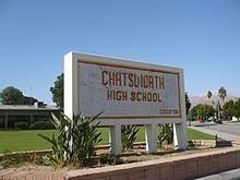
Schools
Schools within the Chatsworth boundaries are:
Public
Private
Parks and recreation
The City of Los Angeles Parks and Recreation Department, California Department of Parks and Recreation, County of Los Angeles, California State Park Volunteers, and the Santa Monica Mountains Conservancy operate the various natural open space preserve parks and neighborhood recreation parks.
Open-space parks
Neighborhood parks
Chatsworth Reservoir
A distinctive feature in Chatsworth is the Chatsworth Dam and reservoir. Built in 1918 as part of the Los Angeles Aqueduct system, the property belongs to the Los Angeles Department of Water and Power. Due to increasing concerns of the water quality because of algae plumes and storm water inflow, it was taken out of service in August 1969. After the 1971 San Fernando earthquake additional concerns for seismic safety led to its abandonment by the LADWP as a storage facility. Chatsworth Oaks Park and the Chatsworth Nature Preserve are located here giving views of migrating birds and other animals, and their sounds such as the coyotes calling in the evening. The views of the rocky and dramatic Simi Hills surround the open space.
Chatsworth Reservoir is classified by the Los Angeles Times as a city neighborhood, but "because there are relatively few homes in this area," the Times does not provide separate statistics for it but adds them to Chatsworth. The Devonshire and Topanga stations of the Los Angeles Police Department provide services in the area.
Economy
Chatsworth is the home of the National Notary Association and the headquarters for Premier America (Formerly Litton Federal Credit Union) and Matadors Community Credit Union.
The Santa Susana Field Laboratory (SSFL), once busy with Rocketdyne testing rocket engines and Atomics International doing nuclear research, is quiet and high in the Simi Hills west of Chatsworth. It has been closed and will be undergoing an extensive environmental cleanup, and become an open-space park. The park will permanently add to Chatsworth's scenic backdrop, greenway, and hiking opportunities.
Some current businesses based in Chatsworth are: Capstone Turbine, Natel Engineering, Hydraulics International, Environment Associates, Inc. and with Lamps Plus having production and distribution facilities here.
Titus Software's United States subsidiary once had its headquarters in Chatsworth.
Seltzer Motor Industries, of Chatsworth, in 1979 produced the The Willow a 2-Seat Sports Car kit. It is known to be the first transverse, inline 4-cylinder, mid-engined kit car ever offered to the public.