
Country United States Elevation 148 m Population 358 (2010) | GNIS feature ID 0453164 Area 46.83 km² Local time Sunday 10:55 PM | |
 | ||
Weather 12°C, Wind S at 19 km/h, 63% Humidity | ||
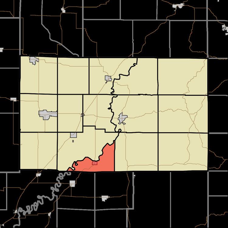
Cass Township is one of fifteen townships in Greene County, Indiana, USA. As of the 2010 census, its population was 358.
Contents
- Map of Cass Township IN USA
- Geography
- Cities and towns
- Adjacent townships
- Cemeteries
- Major highways
- References
Map of Cass Township, IN, USA
Geography
According to the 2010 census, the township has a total area of 18.08 square miles (46.8 km2), of which 17.62 square miles (45.6 km2) (or 97.46%) is land and 0.45 square miles (1.2 km2) (or 2.49%) is water. The streams of Doans Creek, Gilbert Creek, Mud Creek and Woodhouse Branch run through this township.
Cities and towns
Adjacent townships
Cemeteries
The township contains three cemeteries: Gilbreath, Old Slinkard and Slinkard.
Major highways
References
Cass Township, Greene County, Indiana Wikipedia(Text) CC BY-SA