
Congressional district At-large Website www.co.cass.nd.us Founded 1872 | Area 4,579 km² Population 162,829 (2013) Unemployment rate 2.5% (Apr 2015) | |
 | ||
Colleges and Universities North Dakota State Uni, Josef's School of Hair Desi, Rasmussen College‑Fargo - main cam, Lynnes Welding Training - I, Josef's West Academy | ||
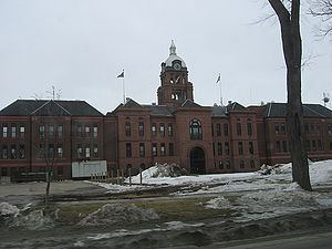
Cass County is a county located in the U.S. state of North Dakota. As of the 2010 census, the population was 149,778, and was estimated to be 171,512 in 2015. Cass County is the most populous county in North Dakota, accounting for nearly 23% of the state's population. Its county seat is Fargo, the most populous city in the state. The county was organized on October 27, 1873.
Contents
- Map of Cass County ND USA
- History
- Geography
- Adjacent counties
- 2000 census
- 2010 census
- Government
- Census designated places
- Other communities
- References
Map of Cass County, ND, USA
Cass County is part of the Fargo, ND-MN Metropolitan Statistical Area.
History
Cass County dates back to the days of the Dakota Territory. It was one of the original counties defined in 1872, and was organized on October 27, 1873, at a meeting in Fargo. It was named after railroad executive George Washington Cass (1810 - 1888).
Geography
According to the U.S. Census Bureau, the county has a total area of 1,768 square miles (4,580 km2), of which 1,765 square miles (4,570 km2) is land and 3.0 square miles (7.8 km2) (0.2%) is water.
Adjacent counties
2000 census
As of the census of 2000, there were 123,138 people, 51,315 households, and 29,814 families residing in the county. The population density was 70 people per square mile (27/km²). There were 53,790 housing units at an average density of 30 per square mile (12/km²). The racial makeup of the county was 95.10% White, 0.81% Black or African American, 1.08% Native American, 1.26% Asian, 0.03% Pacific Islander, 0.43% from other races, and 1.29% from two or more races. 1.23% of the population were Hispanic or Latino of any race. 34.1% were of German and 32.4% Norwegian ancestry.
There were 51,315 households out of which 29.9% had children under the age of 18 living with them, 47.3% were married couples living together, 7.6% had a female householder with no husband present, and 41.9% were non-families. 31.2% of all households were made up of individuals and 7.6% had someone living alone who was 65 years of age or older. The average household size was 2.32 and the average family size was 2.98.
In the county, the population was spread out with 23.4% under the age of 18, 16.0% from 18 to 24, 31.3% from 25 to 44, 19.6% from 45 to 64, and 9.7% who were 65 years of age or older. The median age was 31 years. For every 100 females there were 100.3 males. For every 100 females age 18 and over, there were 99.5 males.
The median income for a household in the county was $38,147, and the median income for a family was $51,469. Males had a median income of $32,216 versus $22,300 for females. The per capita income for the county was $20,889. About 5.7% of families and 10.1% of the population were below the poverty line, including 9.1% of those under age 18 and 8.1% of those age 65 or over.
2010 census
As of the 2010 United States Census, there were 149,778 people, 63,899 households, and 35,215 families residing in the county. The population density was 84.9 inhabitants per square mile (32.8/km2). There were 67,938 housing units at an average density of 38.5 per square mile (14.9/km2). The racial makeup of the county was 91.7% white, 2.4% Asian, 2.3% black or African American, 1.2% American Indian, 0.5% from other races, and 1.9% from two or more races. Those of Hispanic or Latino origin made up 2.0% of the population. In terms of ancestry, 45.4% were German, 35.8% were Norwegian, 9.2% were Irish, 6.3% were Swedish, and 1.7% were American.
Of the 63,899 households, 27.8% had children under the age of 18 living with them, 42.9% were married couples living together, 8.3% had a female householder with no husband present, 44.9% were non-families, and 33.0% of all households were made up of individuals. The average household size was 2.27 and the average family size was 2.94. The median age was 31.5 years.
The median income for a household in the county was $47,600 and the median income for a family was $68,858. Males had a median income of $42,557 versus $31,916 for females. The per capita income for the county was $28,184. About 5.8% of families and 12.8% of the population were below the poverty line, including 11.0% of those under age 18 and 10.1% of those age 65 or over.
Government
Cass County is governed by a board of commissioners, each elected to a four-year term. Other elected officials include the auditor, recorder, sheriff, state's attorney, and treasurer. Appointed officials include administrator, extension agent, director of tax equalization, highway engineer, information technology coordinator, social services officer, veterans service officer, and weed control officer.
The current Sheriff is Paul D. Laney. Laney has served as Sheriff of Cass County since January 2, 2007.