
Founded 1837 Unemployment rate 4.8% (Apr 2015) | Congressional district 18th Area 994.6 km² Population 13,324 (2013) | |
 | ||
Cities | ||
Cass County is a county located in the U.S. state of Illinois. As of the 2010 census, the population was 13,642. Its county seat is Virginia. It is the home of the Jim Edgar Panther Creek State Fish and Wildlife Area.
Contents
- Map of Cass County IL USA
- History
- Geography
- Adjacent counties
- National protected area
- Rivers
- Major highways
- Climate and weather
- Demographics
- Education
- Cities
- Villages
- Townships
- References
Map of Cass County, IL, USA
History
Cass County was formed in 1837 out of Morgan County. It was named in honor of Lewis Cass, a general in the War of 1812, Governor of the Michigan Territory, and United States Secretary of State in 1860. Cass was serving as Andrew Jackson's Secretary of War just before the County was named.
Geography
According to the U.S. Census Bureau, the county has a total area of 384 square miles (990 km2), of which 376 square miles (970 km2) is land and 7.9 square miles (20 km2) (2.1%) is water.
Adjacent counties
National protected area
Rivers
Major highways
Climate and weather
In recent years, average temperatures in the county seat of Virginia have ranged from a low of 15 °F (−9 °C) in January to a high of 87 °F (31 °C) in July, although a record low of −28 °F (−33 °C) was recorded in February 1934 and a record high of 114 °F (46 °C) was recorded in July 1954. Average monthly precipitation ranged from 1.35 inches (34 mm) in January to 4.86 inches (123 mm) in May.
Demographics
As of the 2010 United States Census, there were 13,642 people, 5,270 households, and 3,561 families residing in the county. The population density was 36.3 inhabitants per square mile (14.0/km2). There were 5,836 housing units at an average density of 15.5 per square mile (6.0/km2). The racial makeup of the county was 86.3% white, 3.1% black or African American, 0.3% Asian, 0.3% American Indian, 8.7% from other races, and 1.4% from two or more races. Those of Hispanic or Latino origin made up 16.8% of the population. In terms of ancestry, 22.6% were German, 21.0% were American, 10.6% were Irish, and 9.5% were English.
Of the 5,270 households, 33.9% had children under the age of 18 living with them, 51.1% were married couples living together, 10.9% had a female householder with no husband present, 32.4% were non-families, and 26.5% of all households were made up of individuals. The average household size was 2.55 and the average family size was 3.06. The median age was 38.7 years.
The median income for a household in the county was $41,544 and the median income for a family was $51,624. Males had a median income of $37,267 versus $26,634 for females. The per capita income for the county was $19,825. About 10.1% of families and 12.9% of the population were below the poverty line, including 14.2% of those under age 18 and 9.2% of those age 65 or over.
Education
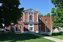
Cities
Villages
Townships
Cass County is divided into these eleven townships: