
Named for Jacob Brown Congressional district 18th Website browncountyil.com Area 795.1 km² | Founded 1839 Population 6,860 (2013) Unemployment rate 2.9% (Apr 2015) | |
 | ||
Rivers Illinois River, La Moine River, Missouri Creek | ||
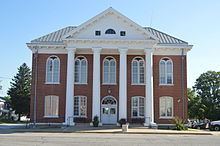
Brown County is a county located in the U.S. state of Illinois. As of the 2010 census, the population was 6,937. Its county seat is Mount Sterling.
Contents
- Map of Brown County IL USA
- History
- Geography
- Adjacent counties
- Major highways
- Climate and weather
- Demographics
- Politics
- Education
- City
- Villages
- Townships
- References
Map of Brown County, IL, USA
Siloam Springs State Park is located partly in this county.
History
Brown County was formed out of Schuyler County in 1839. It is named in honor of U.S. General Jacob Brown, who defeated the British at the Battle of Sackett's Harbor in 1813.
Geography
According to the U.S. Census Bureau, the county has a total area of 307 square miles (800 km2), of which 306 square miles (790 km2) is land and 1.6 square miles (4.1 km2) (0.5%) is water. The Illinois River flows along part of the county's eastern border.
Adjacent counties
Major highways
Climate and weather
In recent years, average temperatures in the county seat of Mount Sterling have ranged from a low of 15 °F (−9 °C) in January to a high of 87 °F (31 °C) in July, although a record low of −26 °F (−32 °C) was recorded in February 1905 and a record high of 113 °F (45 °C) was recorded in July 1936. Average monthly precipitation ranged from 1.55 inches (39 mm) in January to 5.14 inches (131 mm) in May.
Demographics
As of the 2010 United States Census, there were 6,937 people, 2,099 households, and 1,346 families residing in the county. The population density was 22.7 inhabitants per square mile (8.8/km2). There were 2,462 housing units at an average density of 8.1 per square mile (3.1/km2). The racial makeup of the county was 76.1% white, 18.5% black or African American, 0.2% Asian, 0.2% American Indian, 4.4% from other races, and 0.6% from two or more races. Those of Hispanic or Latino origin made up 5.8% of the population. In terms of ancestry, 25.5% were German, 15.6% were American, 12.7% were Irish, and 6.1% were English.
Of the 2,099 households, 28.4% had children under the age of 18 living with them, 51.3% were married couples living together, 8.6% had a female householder with no husband present, 35.9% were non-families, and 32.2% of all households were made up of individuals. The average household size was 2.30 and the average family size was 2.88. The median age was 37.3 years.
The median income for a household in the county was $38,696 and the median income for a family was $50,341. Males had a median income of $34,648 versus $27,288 for females. The per capita income for the county was $17,133. About 9.9% of families and 12.0% of the population were below the poverty line, including 15.0% of those under age 18 and 9.2% of those age 65 or over.
The Illinois state prison, Western Illinois Correctional Center, located south east of Mount Sterling, has an average daily population of 2,066. The all male population and racial makeup of the prison is so large, compared to the rest of the county, that it skews the census demographic data. This is evidenced by the lopsided age pyramid.[1]
Politics
Brown County is located in Illinois's 18th Congressional District and is currently represented by Republican Davin LaHood. For the Illinois House of Representatives, the county is located in the 93rd district and is currently represented by Republican Norine Hammond. The county is located in the 47th district of the Illinois Senate, and is currently represented by Democrat John Sullivan, but will be represented by Republican Jil Tracy beginning in January 2017.
Brown County voted for the Democratic candidate in every presidential election from at least 1840 through 1948, with the sole exception of the 1928 election when the county voted for the Republican candidate Herbert Hoover. From 1952-2016, Democrats have carried Brown County only three times (1964, 1976, and 1992) and have won a majority of the vote only once (1964).
Education
City
Villages
Townships
Brown County is divided into these nine townships: