
Existed: 2000 – present Constructed 2000 | Length 453 km | |
 | ||
History: Completed on 21 June 2010 | ||
The Autoroute Casablanca–Agadir is a new main road in Morocco. Building began in 2000 and the road was inaugurated on 21 June 2010 by Prince Moulay Rachid.
Contents
Map of A7, Morocco
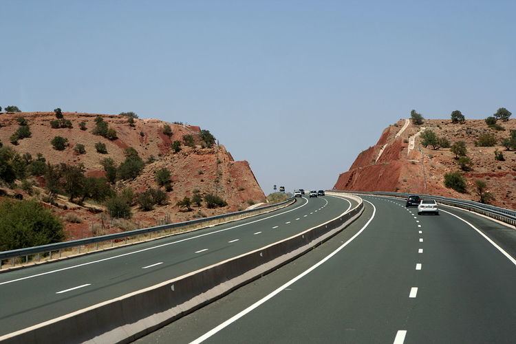
The road is 453 km (281 mi) long and connects the cities of Casablanca and Agadir through the city of Marrakesh and High Atlas mountains.
Casablanca–Marrakesh
It has been designated A7 as its identity marker. Total length is 219 km: 57 km Casablanca–Settat and 162 km Setat–Marrakech
The expressway takes its origins south of the residential area of Casablanca, at the interchange with the A5 Casablanca–El Jadida expressway. It continues south past Bouskoura and serves the Mohamed V airport with an exit. A toll station is placed just south of there. The road then circumvales the town of Berrechid serving it with an exit north of it for south-bound traffic and one south of it for north-bound traffic.
The road was opened in 2002 to Settat, and construction on the remaining part started in 2003 reaching Marrakesh in 2007. In 2005 the 17 km bypass of Settat opened. When the Marrakech–Agadir expressway opens in 2009 it will be directly connected to this A7.
The Casablanca–Marrakesh highway was completed and opened to traffic on April 17, 2007.
Toll-revenues of this road, including the Casablanca bypass, totaled 219 million dirhams, reaching 3rd spot of top earners
Financial
In June 2004 the Moroccan operator of expressways ADM signed an agreement with the Hasan II Society for economic and social development for a refinancing scheme of the ADM. This financial injection made construction of new roads possible and construction started in 2006.
The road will be a toll road or péage to pay back the investments. Also income from retailers and petrolstations along the route is taken into account.
Beside the ADM several other parties are involved. Some major investors participate for specific sections of the road or a general goal.
The main investors are (in million dirham)
Overview
Below is a short overview of the different sub-projects, the costs (against the estimated costs) and the main contractors for that section. For some sections, only contractors for initial work are reported.
Construction
Work is divided in several main sections, each with their own contractors and workers. Construction of a 4-lane motorway through the mountains of the High Atlas requires much structures as fly-overs, viaducts and bridges. The existing national road (route nationale) is used for transport of building material etc. Along this route new exits and side roads are constructed to several main working locations and temporary factories (concrete, storage, camp-sites for builders, etc.).
The new road crosses the existing road several times and follows more or less the same route through the mountains.
layout
Over the full length the new autoroute will have:
The road has 8 exits/entries, 9 toll-port gates and 4 rest stops with petrol stations, cafés and a room or building for praying. Also 13 viaducts and one tunnel was built to complete the road (excluding viaducts built over the road and/or tunnels under the road for crossing inferior local roads or feet-bridges: if you include these another 100 structures can be included.
Toll road
As (nearly) all Moroccan expressways this new section is also a toll road.
The existing national road will remain open as a toll-free alternative for the autoroute as well as allowing access to smaller villages and roads. Traveling time between Marrakech and Agadir will be reduced greatly as the autoroute allows overtaking everywhere (4 lane), bypasses villages and allows higher speeds. Possible speed on 2-lane national roads is often greatly reduced due to very slow lorries crawling up a hill while steep bends and traffic from the other side make overtaking hazardous or impossible.
The completion of the Marrakesh–Agadir section complete a north-south corridor of toll-roads / expressways that shortens the travel-distance on the route Tangier to Agadir by nearly 50 km (via toll-roads the distance is 776 and via the Route Nationale 824 km. But the biggest save is driving-time: the average traveling time Tangier–Agadir over national (free) roads is 14.5 hours while the same via the different toll-roads is under 7.5 hours