
County Bartow Named for Farish Carter Elevation 240 m Population 20,001 (2013) | Incorporated 1850 Time zone Eastern Time (UTC-5) Local time Sunday 3:50 PM | |
 | ||
Weather 19°C, Wind S at 10 km/h, 26% Humidity Neighborhoods Wildwood, North Highland, Junta | ||
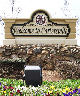
Cartersville is a city in Bartow County in the U.S. state of Georgia; it is located within the northwest edge of the Atlanta metropolitan area. As of the 2010 census, the city had a population of 19,731. Cartersville is the county seat of Bartow County.
Contents
- Map of Cartersville GA USA
- History
- Geography
- Transportation
- Cartersville area communities
- Demographics
- Points of interest
- Education
- Economy
- References
Map of Cartersville, GA, USA
History
Cartersville was first known as Birmingham to its original English settlers. The town was incorporated as Cartersville in 1854. The present name is for Col. F. Carter of Milledgeville.
Cartersville was designated the seat of Bartow County in 1867 following the destruction of Cassville by Sherman in the American Civil War. Cartersville was incorporated as a city in 1872.
Geography
Cartersville is located in south-central Bartow County, 42 miles (68 km) northwest of downtown Atlanta and 76 miles (122 km) southeast of Chattanooga, Tennessee.
The Etowah River flows through a broad valley south of the downtown, leading west to Rome, where it forms the Coosa River, a tributary of the Alabama River. The city limits extend eastward, upriver, as far as Allatoona Dam, which forms Lake Allatoona, a large U.S. Army Corps of Engineers reservoir. Red Top Mountain State Park sits on a peninsula in the lake, just outside the city limits. Nancy Creek also flows in the vicinity.
According to the U.S. Census Bureau, Cartersville has a total area of 29.3 square miles (75.9 km2), of which 29.2 square miles (75.5 km2) is land and 0.15 square miles (0.4 km2), or 0.59%, is water.
Downtown Cartersville
Downtown Cartersville consists of several amenities such as shopping, theatres, museums, churches, and restaurants. This downtown district is very small and historic, which is what makes this small town invite-able. The Grand Theatre holds shows for several schools and companies, such as the Steps of Faith Dance Company and Cartersville City Ballet. There are also pageants and scholarship programs that are held here, such as Distinguished Young Women. Downtown Cartersville also has annual Christmas parades and monthly car shows.
Transportation
Interstate 75, the major north-south route through the area, passes through the eastern edge of the city, with access from five exits: Exit 285 just south of the city limits in Emerson, Exit 288 (East Main Street) closest to downtown, and exits 290, 293, and 296 along the city's northern outskirts. U.S. Highway 41, which is concurrent with State Route 3, is an older, parallel highway to Interstate 75 that goes through the eastern edge of downtown, leading north to Calhoun and Dalton and south to Marietta. U.S. Highway 411 passes through the northern edge of the city, leading west to Rome and north to Chatsworth. State Route 20 runs west to Rome concurrent with U.S. Highway 411 and runs east to Canton. State Route 61 runs north to White concurrent with U.S. Highway 411 and runs south to Dallas, Georgia. State Route 113 runs southwesterly to Rockmart. State Route 293 runs west-northwest to Kingston.
Cartersville area communities
The following communities border the city:
Demographics
As of the census of 2010, there were 19,010 people, 5,870 households, and 4,132 families residing in the city. The population of Cartersville is growing significantly. The population density was 680.7 people per square mile (262.9/km²). There were 6,130 housing units at an average density of 262.0 per square mile (101.2/km²). The racial makeup of the city was 63.93% White, 29.64% African American, 0.82% Asian, 0.28% Native American, 0.04% Pacific Islander, 3.76% from other races, and 1.53% from two or more races. Hispanic or Latino of any race were 7.28% of the population.
There were 5,870 households out of which 33.3% had children under the age of 18 living with them, 52.6% were married couples living together, 13.6% had a female householder with no husband present, and 29.6% were non-families. 25.9% of all households were made up of individuals and 11.7% had someone living alone who was 65 years of age or older. The average household size was 2.59 and the average family size was 3.10.
In the city, the population was spread out with 25.9% under the age of 18, 8.7% from 18 to 24, 30.2% from 25 to 44, 20.8% from 45 to 64, and 14.4% who were 65 years of age or older. The median age was 36 years. For every 100 females there were 95.4 males. For every 100 females age 18 and over, there were 92.1 males.
The median income for a household in the city was $41,162, and the median income for a family was $48,219. Males had a median income of $35,092 versus $25,761 for females. The per capita income for the city was $19,977. About 8.9% of families and 11.4% of the population were below the poverty line, including 13.7% of those under age 18 and 15.4% of those age 65 or over.
Points of interest
Education
The schools that comprise the Cartersville City School System:
There are also two private Christian schools:
There is also a private Montessori school:
Cartersville also has a college campus:
Economy
Manufacturing, tourism, and services play a part in the economy of the city. The city's employers include:
The city is home to Cartersville Medical Center and The Hope Center, making it a minor healthcare hub for the surrounding area.