
Elevation 232 m (761 ft) Time zone CET (UTC+1) Local time Saturday 6:50 PM | Demonym(s) Carobbiesi Postal code 24060 Dialling code 035 | |
 | ||
Frazioni Cicola, Santo Stefano degli Angeli Weather 8°C, Wind E at 16 km/h, 81% Humidity | ||
Carobbio degli Angeli is a comune (municipality) in the Province of Bergamo in the Italian region of Lombardy, located about 60 kilometres (37 mi) northeast of Milan and about 13 kilometres (8 mi) southeast of Bergamo.
Contents
- Map of 24060 Carobbio degli Angeli Province of Bergamo Italy
- Acetaia a carobbio degli angeli
- History
- Main sights
- References
Map of 24060 Carobbio degli Angeli, Province of Bergamo, Italy
Carobbio degli Angeli borders the following municipalities: Bolgare, Chiuduno, Gandosso, Gorlago, Grumello del Monte, Trescore Balneario.
Acetaia a carobbio degli angeli
History
The village has Roman origins. In the 14th century AD it received a castle. Later it was a possession of the Republic of Venice.
The current comune was created in 1928 through the merger of Carobbio and Santo Stefano degli Angeli.
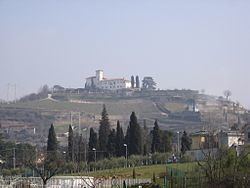
Main sights
References
Carobbio degli Angeli Wikipedia(Text) CC BY-SA