
Founded July 1, 1949 Demonym(s) carmense, carmelita | Barangays Area 311 km² | |
 | ||
District 2nd district of Agusan del Norte | ||
Carmen, officially the Municipality of Carmen (Filipino: Bayan ng Carmen), is a municipality in the province of Agusan del Norte in the Caraga (Region XIII) of the Philippines. The population was 20,839 at the 2015 census. In the 2016 electoral roll, it had 12,492 registered voters.
Contents
- Map of Carmen Agusan Del Norte Philippines
- Carmen agusan del norte tourism
- History
- Geography
- Barangays
- Demographics
- Local government
- Attractions
- Schools
- References
Map of Carmen, Agusan Del Norte, Philippines
Carmen agusan del norte tourism
History
Formerly, Carmen was called Kabayawa by the Manobo natives. Carmen got its present name from the miraculous image of the Virgin of Mount Carmen, believed to have been instrumental in killing the leader of the bandits who used to inhabit the place.
A Spanish Soldier named Juan Cardoniga was supposed to have fired his rifle at the leader of the outlaws who possessed an amulet of some source. Since his rifle did not work, Cardoniga got the image of the virgin from his necklace and place it inside the hole of the barrel after which he succeeded in firing the rifle and in killing the outlaw chief.
It was Rev. Saturnino Urios, the famous Jesuit priest of Agusan, who suggested that the name Kabayawa be changed to Carmen in honor of the secret image.
Carmen was created into a municipality in 1949, when the barrios of Carmen, Tagcatong, Cahayagan and San Agustin were separated from the municipality of Nasipit and constituted into the newly created town, by virtue of Republic Act No. 380 which was approved on June 15, 1949. This law was sponsored by Congressman Marcos M. Calo. The town came into being on July 1, 1949.
Geography
Carmen is located at 9°00′N 125°16′E.
According to the Philippine Statistics Authority, the municipality has a land area of 311.02 square kilometres (120.09 sq mi) constituting 7001113900000000000♠11.39% of the 2,730.24-square-kilometre- (1,054.15 sq mi) total area of Agusan del Norte.
Carmen is strategically located in the Western Agusan Corridor. It is bounded on the north by the Butuan Bay, south by Buenavista, east by Nasipit and west by Misamis Oriental. Its rolling hills are planted with different kinds of orchard, where some 500 hectares (1,200 acres) are devoted solely to mango plantations. About half of these are fully developed and are already producing sweet mango fruits which are being sold in volume in Cebu and Manila and to neighboring municipalities and Butuan City.
Barangays
Carmen is politically subdivided into 8 barangays.
Demographics
In the 2015 census, Carmen had a population of 20,839. The population density was 67 inhabitants per square kilometre (170/sq mi).
In the 2016 electoral roll, it had 12,492 registered voters.
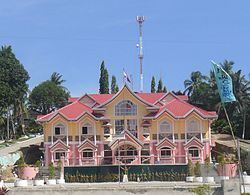
Local government
Elected government officials of Carmen for the term of 2016-2019: