
Elevation 1,544 m | ||
 | ||
Similar Mount Barrington, Polblue, Mount Allyn, Mount Royal, Mount Cabrebald | ||
Barrington tops careys peak july 2015 snow
Careys Peak is a peak in the Williams Range, part of the Mount Royal Range, located in the Upper Hunter region of New South Wales, Australia. At 1,544 metres (5,066 ft) above sea level, it is one of the higher points in Barrington Tops National Park, some 200 kilometres (120 mi) north of Sydney. The peak is at the edge of the Barrington Tops plateau, within the declared wilderness of the World Heritage Gondwana Rainforests of Australia.
Contents
- Barrington tops careys peak july 2015 snow
- Map of Careys Peak Upper Allyn NSW 2311 Australia
- Careys peak hike
- GeologyEdit
- FloraEdit
- FaunaEdit
- References
Map of Careys Peak, Upper Allyn NSW 2311, Australia
Wilderness streams, such as the Allyn River and Williams River rise nearby. On a clear day, the higher peaks of the Blue Mountains may be seen. And looking south east, the sands of Stockton Beach on the coast may be viewed. The scenic appeal of the area is well regarded. Particularly the large dark stands of rainforest and snow gum wilderness. Snow has been recorded here as early as Easter. Careys Peak is a popular camping and bushwalking destination. Many years ago, a skiing slope was cleared behind Careys Peak. It has since disappeared in natural bush re-growth.
The historic hut was built around the year 1934. It was crushed by a fallen tree in the 1970s. Rebuilt in 1973 and repaired again in 2007. Closing the four wheel drive tracks to vehicular traffic is said to slow the spread of invasive weeds, such as Scotch broom, mist flower and crofton weed.
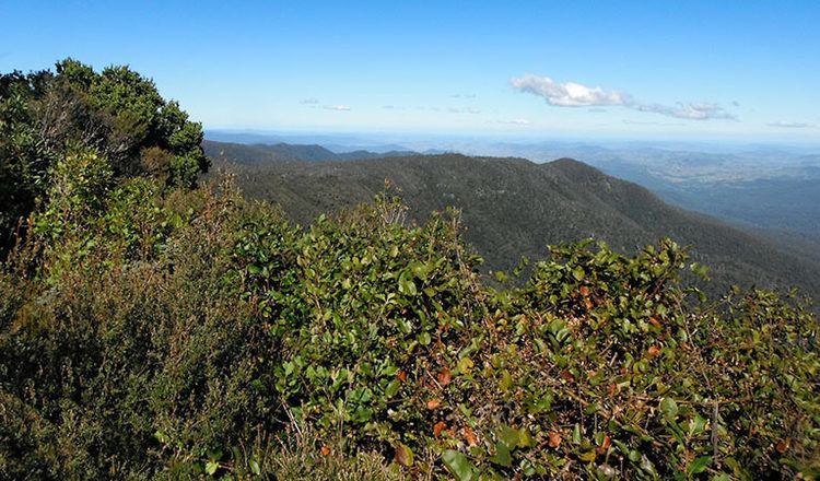
Careys peak hike
GeologyEdit
The geology of the area includes Alkali Gabbro, a type of igneous rock. Careys Peak was a vent of the Barrington Volcano. During the Eocene Period, a large basalt flow covered most of the nearby plateau. Below are older Permian Granodiorites and Devonian-Carboniferous sedimentary rocks, such as mudstones, siltstones, minor conglomerates and limestones.
FloraEdit
The surrounding area is heavily forested. Sub alpine woodland grows on the plateau. On the escarpment, Cool temperate rainforest is dominated by the Antarctic beech. Other interesting plants nearby include the snow gum, southern sassafras and broad-leaved pepperbush. A two pronged landslip occurred in the rainforest at Careys Peak in 1978. This area is now slowly being naturally re-vegetated, initially by non rainforest species. It is expected to return to the original Antarctic beech rainforest.
FaunaEdit
Animals in the area include wombats, eastern quoll, pademelons, eastern grey kangaroos and swamp wallabies. Lyrebirds may be seen in the undergrowth, and yellow-tailed black cockatoos are common overhead.