
Length 60 km | - elevation 655 m (2,149 ft) - elevation 15 m (49 ft) | |
 | ||
- left Chads Creek, Stony Creek (Dungog, New South Wales), Lewinsbrook Creek, McIntyre Creek, Mirari Creek - right Masseys Creek, Bucks Creek Source Barrington Tops National Park | ||
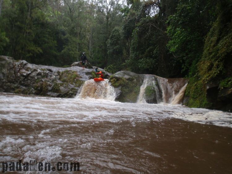
Upper allyn river ladies well section
Allyn River, a perennial stream of the Hunter River catchment, is located in the Hunter region of New South Wales, Australia.
Contents
- Upper allyn river ladies well section
- Map of Allyn River New South Wales Australia
- Allyn river rd allynbrook nsw wmv
- CourseEdit
- HistoryEdit
- References
Map of Allyn River, New South Wales, Australia
Allyn river rd allynbrook nsw wmv
CourseEdit
Allyn River rises on Allyn Range, on the slopes of the Gondwana Rainforests Barrington Tops, west of Careys Peak, and flows generally southeast, joined by seven minor tributaries, before reaching its confluence with the Paterson River near Vacy; descending 640 metres (2,100 ft) over its 82-kilometre (51 mi) course.
The course of the river flows through World Heritage listed high altitude rainforest, noted for its Antarctic Beech; and then through lower altitude subtropical rainforest, including trees such as Red Cedar and Small leaf fig. Some of the River Oak growing beside the stream are over 50 metres (160 ft) in height. Logging has been practiced in the area since the 1820s.
HistoryEdit
The Allyn River valley is the traditional territory of the Gringai clan of the Wonnarua people, a group of indigenous people of Australia.