
Elevation 1,555 m | ||
 | ||
Similar Careys Peak, Polblue, Mount Allyn, Mount Royal, Mount Cabrebald | ||
Mount Barrington, a mountain that is part of the Mount Royal Range, is located on the Barrington Tops plateau in the Mid-Coast Council within New South Wales, Australia and has an elevation of 1,555 metres (5,102 ft) above sea level.
Map of Mount Barrington, Barrington Tops NSW 2422, Australia
Now the remnants of a volcano, Mount Barrington, formerly the Barrington Volcano, erupted near its present peak between 44 and 54 million years ago. The eruption caused a 700-cubic-kilometre (170 cu mi) basalt flow, which covered much of the Barrington Tops plateau. The lava was up to 1,000 metres (3,300 ft) thick.
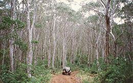
The extensive rainforests in the area grow on much of the resultant red/brown soils. Gemstones such as zircon, sapphire and ruby were formed from the volcano. Nearby Careys Peak is considered a vent in this extinct shield volcano. The surrounding area is covered by sub alpine Snow Gum woodland, with rainforest on the escarpment edge and in fire free gullies.