
Time zone BRT (UTC-3) Area 485.1 km² Local time Thursday 6:59 PM | Founded April 20, 1857 Elevation 2 m Population 55,414 (2010) | |
 | ||
Metropolitan Region Vale do Paraíba e Litoral Norte Weather 24°C, Wind N at 11 km/h, 80% Humidity Points of interest Praia da Cocanha, FUNDACC, Praia de Martin de Sá, Morro Santo Antônio, Praia da Tabatinga | ||
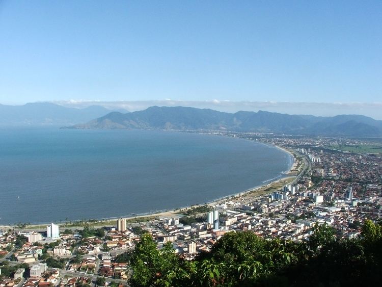
Caraguatatuba, widely known by its abbreviation Caraguá, is a city in the eastern part of the southern state of São Paulo in Brazil. It is part of the Metropolitan Region of Vale do Paraíba e Litoral Norte. The population is 113,317 (2015 est.) in an area of 485.10 km². Caraguatatuba is the largest city of São Paulo north shore. The economy of the Caraguatatuba is driven by agriculture and tourism. The urban area and farmlands are within the coastline and valley areas, the majority of the northern part are heavily forested and rarely serves any roads to that area. The postal boundary dividing the 00000s and the 10000s lies to the southwestern boundary with Salesópolis.
Contents
Map of Caraguatatuba, State of S%C3%A3o Paulo, Brazil
Geography
Caraguatatuba is located between the Atlantic Ocean and the Serra do Mar and is home to the Parque Estadual da Serra do Mar. Its neighboring cities are Natividade da Serra to the north, Ubatuba to the northeast, the Atlantic Ocean to the southeast (with the island of Ilha Bela to the south), São Sebastião to the south, Salesópolis to the west and Paraibuna northwest.
Beaches
There are 17 beaches in Caraguatatuba from north to south, they are: