
 | ||
Colleges and Universities University of Victoria, Camosun College, Royal Roads University, St Michaels University, Pearson College UWC Points of interest Beacon Hill Park, Royal British Columbia, Butchart Gardens, Craigdarroch Castle, British Columbia Parliame | ||
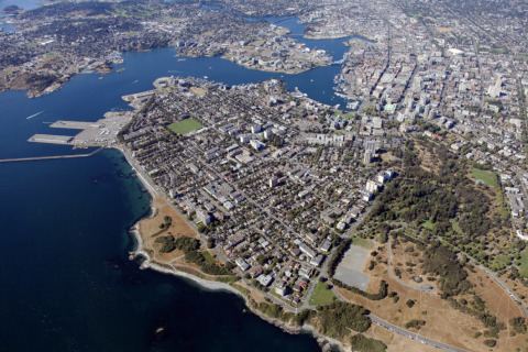
The Capital Regional District (CRD) is a local government administrative district encompassing the southern tip of Vancouver Island and the southern Gulf Islands in the Canadian province of British Columbia. The CRD is one of several regional districts in British Columbia and had an official population of 383,360 as of the Canada 2016 Census.
Contents
- Map of Capital BC Canada
- Incorporated municipalities
- Salt Spring Island Electoral Area
- Southern Gulf Islands Electoral Area
- Juan de Fuca Electoral Area
- Administrative role
- Capital Regional Hospital District
- References
Map of Capital, BC, Canada
The CRD encompasses the thirteen municipalities of Greater Victoria and the Juan de Fuca Electoral Area on Vancouver Island, the Salt Spring Electoral Area, and the Southern Gulf Islands Electoral Area. Its headquarters is in the City of Victoria, although there are many office and operational facilities throughout the region. The total land area is 2,341.11 km2 (903.91 sq mi).
The CRD was formed in 1966 as a federation of seven municipalities and five electoral areas to provide coordination of regional issues and local government in rural areas in the Greater Victoria region.
Incorporated municipalities
*(Map of member municipalities)
Salt Spring Island Electoral Area
(map)
The Salt Spring Island Electoral Area of the Capital Regional District (CRD) of the Canadian province of British Columbia consists of unincorporated areas in the CRD located on Salt Spring Island. It is represented by one director on the CRD.
The major localities encompassed by the electoral area are:
According to the Canada 2006 Census:
Southern Gulf Islands Electoral Area
(map)
The Southern Gulf Islands Electoral Area of the Capital Regional District (CRD) of the Canadian province of British Columbia consists of unincorporated districts in the CRD located on Galiano, Saturna, Mayne, and North and South Pender Islands, as well as many smaller islands located in the Gulf of Georgia north and east of Victoria. It is previously known as the Outer Gulf Islands Electoral Area. Its population of 5,101 is represented by one director on the CRD.
The major localities encompassed by the electoral area are:
Juan de Fuca Electoral Area
(map) The Juan de Fuca Electoral Area is an Electoral Area of the CRD. It consists of the neighbourhood of Willis Point (Greater Victoria) on Saanich Inlet, Malahat, on the western shore of Saanich Inlet, and the Western Communities localities of East Sooke, Jordan River, Otter Point, Shirley, Port Renfrew, inclusive of the First Nations reserves of Gordon River 2 and Pacheena 1, which are within its territory. Its population of 4,484 is represented by a single director of the CRD. The total land area is 1,502.24 km² (580.0 sq mi). Population figures do not included residents of Indian Reserves, whether band members or non-indigenous persons.
Administrative role
The board of directors are either directly elected officials or are appointed from within the region's elected municipal councils.
The CRD's responsibilities include recycling, operating the regional landfill, building and operating sewage treatment plants, a sewer source control program, regional water supply, funding for non-profit arts groups, regional planning, funding health facilities, and overseeing thirty regional parks, trails, and regional park reserves encompassing over 100 km². The CRD is the sole shareholder of the Capital Region Housing Corporation, which owns and operates over 1200 rental housing units. In certain areas, the CRD can pass bylaws that are binding on a portion of the geographical area or the entire geographical area. These include a "clean air bylaw" smoking ban in all public places and patios in restaurants/pubs.
The CRD assumes responsibilities ordinarily undertaken by municipalities in unincorporated areas of the CRD. These responsibilities include animal control, building inspection, fire protection, and bylaw enforcement. Some of the region's municipalities avail themselves of some of these services in a contractual arrangement with the CRD.
Capital Regional Hospital District
The CRHD's primary responsibility is to provide the region's share of capital funding for the region’s health facilities and equipment. The region's health care delivery is the responsibility of the Vancouver Island Health Authority (VIHA). The CRHD shares the same Board of Directors with the CRD.