
Country United States Area 82 ha Local time Wednesday 12:54 PM | Incorporated April 19, 1878 Zip code 08212 Population 285 (2013) | |
 | ||
Area rank 553rd of 566 in state16th of 16 in county Weather 13°C, Wind W at 19 km/h, 48% Humidity | ||
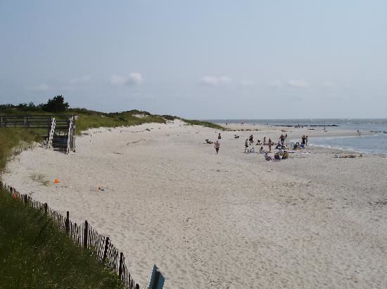
The cape may lighthouse cape may point new jersey
Cape May Point is a borough located at the tip of the Cape May Peninsula in Cape May County. It is part of the Ocean City Metropolitan Statistical Area. As of the 2010 United States Census, the resident population was 291, reflecting an increase of 50 (+20.7%) from the 241 counted in the 2000 Census, which had in turn declined by 7 (-2.8%) from the 248 counted in the 1990 Census. The summer population can be as much as 4,500.
Contents
- The cape may lighthouse cape may point new jersey
- Map of Cape May Point NJ USA
- GeographyEdit
- Census 2010Edit
- Census 2000Edit
- Local governmentEdit
- Federal state and county representationEdit
- PoliticsEdit
- EducationEdit
- TransportationEdit
- Notable peopleEdit
- References
Map of Cape May Point, NJ, USA
Cape May Point is home to the Cape May Light, though Lower Township claims that the lighthouse is located in that municipality.
Cape May Point was called Stites Beach until 1876 when the name was changed to Seagrove. It was incorporated as a borough by an act of the New Jersey Legislature on April 19, 1878, from portions of Lower Township, based on the results of a referendum held three days earlier. It was reincorporated on August 19, 1891 and returned to Lower Township on April 8, 1896. Cape May Point re-emerged as an independent municipality on April 6, 1908, based on the results of a referendum held on April 21, 1908. The borough's name derives from Cape May, which was named for 1620 Dutch captain named Cornelius Jacobsen May who explored and charted the area between 1611–1614, and established a claim for the province of New Netherland.
Cape May Point is a dry town where alcohol cannot be sold.
GeographyEdit
According to the United States Census Bureau, Cape May Point borough had a total area of 0.315 square miles (0.816 km2), including 0.296 square miles (0.766 km2) of land and 0.019 square miles (0.050 km2) of water (6.15%).
Cape May Point borders Lower Township, the Atlantic Ocean and Delaware Bay.
Census 2010Edit
The 2010 United States Census counted 291 people, 164 households, and 100 families residing in the borough. The population density was 984.5 per square mile (380.1/km2). The borough contained 619 housing units at an average density of 2,094.2 per square mile (808.6/km2). The racial makeup of the borough was 94.50% (275) White, 2.75% (8) Black or African American, 0.00% (0) Native American, 0.34% (1) Asian, 0.00% (0) Pacific Islander, 0.34% (1) from other races, and 2.06% (6) from two or more races. Hispanics or Latinos of any race were 0.34% (1) of the population.
Out of a total of 164 households, 4.3% had children under the age of 18 living with them, 55.5% were married couples living together, 3.7% had a female householder with no husband present, and 39.0% were non-families. 34.1% of all households were made up of individuals, and 20.7% had someone living alone who was 65 years of age or older. The average household size was 1.77 and the average family size was 2.17.
In the borough, 4.1% of the population were under the age of 18, 1.7% from 18 to 24, 3.8% from 25 to 44, 34.7% from 45 to 64, and 55.7% who were 65 years of age or older. The median age was 66.4 years. For every 100 females the census counted 84.2 males, but for 100 females at least 18 years old, it was 83.6 males.
The Census Bureau's 2006-2010 American Community Survey showed that (in 2010 inflation-adjusted dollars) median household income was $51,250 (with a margin of error of +/- $36,659) and the median family income was $71,875 (+/- $10,854). Males had a median income of $108,125 (+/- $225,840) versus $ (+/- $) for females. The per capita income for the borough was $37,269 (+/- $13,473). About 8.7% of families and 9.4% of the population were below the poverty line, including 0.0% of those under age 18 and 12.7% of those age 65 or over.
Census 2000Edit
As of the 2000 United States Census there were 241 people, 133 households, and 77 families residing in the borough. The population density was 819.4 people per square mile (320.9/km2). There were 501 housing units at an average density of 1,703.4 per square mile (667.0/km2). The racial makeup of the borough was 95.02% White, 2.07% African American, 0.41% Asian, and 2.49% from two or more races. Hispanic or Latino of any race were 1.66% of the population.
There were 133 households out of which 6.8% had children under the age of 18 living with them, 54.1% were married couples living together, 3.8% had a female householder with no husband present, and 41.4% were non-families. 35.3% of all households were made up of individuals and 23.3% had someone living alone who was 65 years of age or older. The average household size was 1.81 and the average family size was 2.27.
In the borough the population was spread out with 6.6% under the age of 18, 0.8% from 18 to 24, 10.4% from 25 to 44, 34.4% from 45 to 64, and 47.7% who were 65 years of age or older. The median age was 64 years. For every 100 females there were 95.9 males. For every 100 females age 18 and over, there were 89.1 males.
The median income for a household in the borough was $55,313, and the median income for a family was $69,750. Males had a median income of $63,250 versus $30,833 for females. The per capita income for the borough was $52,689. None of the families and 1.7% of the population were living below the poverty line.
Local governmentEdit
Cape May Point operates under the Walsh Act commission form of government, first created to rebuild the city of Galveston, Texas after the devastating Hurricane of 1900. Cape May Point is one of more than 30 municipalities statewide to use this form of government. In three-member Commissions, as in Cape May Point, the Departments of Public Affairs and Public Safety are combined, as are the Departments of Public Works and Parks and Public Property. Revenue and Finance is the third portfolio. The borough adopted this form of government in 1916.
The Commissioners exercise complete control of the operation of the borough, with each Commissioner having all aspects of Administrative, Executive, Judicial, and Legislative powers over their department. The three Commissioners choose a mayor from among themselves at a reorganization meeting following each election, with the mayor responsible for leading municipal meetings and general oversight of community affairs.
Cape May Point shifted its municipal elections from May to November, extending the term-end dates from June 30 to December 31 for the commissioners elected in 2012.
As of 2016, the members of the Board of Commissioners of Cape May Point are Mayor Robert Moffatt (Commissioner of Public Affairs and Public Safety) Deputy Mayor Anita vanHeeswyk (Commissioner of Revenue and Finance) and Robert Mullock (Commissioner of Public Works; serving an unexpired term), all serving concurrent terms of office ending December 31, 2016.
In October 2013, Robert Mullock was appointed to fill the vacant seat of George "Skip" Stanger, who had resigned citing health reasons. In the November 2014 general election, Mullock was elected to serve the balance of the unexpired term.
Federal, state and county representationEdit
Cape May Point is located in the 2nd Congressional District and is part of New Jersey's 1st state legislative district.
New Jersey's Second Congressional District is represented by Frank LoBiondo (R, Ventnor City). New Jersey is represented in the United States Senate by Cory Booker (D, Newark, term ends 2021) and Bob Menendez (D, Paramus, 2019).
For the 2016–2017 session (Senate, General Assembly), the 1st Legislative District of the New Jersey Legislature is represented in the State Senate by Jeff Van Drew (D, Dennis Township) and in the General Assembly by Bob Andrzejczak (D, Middle Township) and R. Bruce Land (D, Vineland). The Governor of New Jersey is Chris Christie (R, Mendham Township). The Lieutenant Governor of New Jersey is Kim Guadagno (R, Monmouth Beach).
Cape May County is governed by a Board of Chosen Freeholders consisting of five members, elected at-large in partisan elections to three-year terms of office on a staggered basis, with one or two seats coming up for election each year; At an annual reorganization held each January, the freeholders select one member to serve as Director and another to serve as Vice-Director. As of 2015, Cape May County's Freeholders are Freeholder Director Gerald M. Thornton (Middle Township, term ends December 31, 2016), Freeholder Vice-Director Leonard C. Desiderio (Sea Isle City, 2015), Kristine Gabor (Upper Township, 2017), E. Marie Hayes (Ocean City, 2016), and Will Morey (Wildwood Crest, 2017). The county's constitutional officers are Sheriff Gary Schafer (Middle Township, 2017), Surrogate M. Susan Sheppard (Ocean City, 2017), and County Clerk Rita Fulginiti (Ocean City, 2015).
PoliticsEdit
As of March 23, 2011, there were a total of 212 registered voters in Cape May Point, of which 99 (46.7%) were registered as Republicans, 63 (29.7%) were registered as Democrats, and 50 (23.6%) were registered as Unaffiliated. There were no voters registered to other parties.
In the 2012 presidential election, Democrat Barack Obama received 52.0% of the vote (91 cast), ahead of Republican Mitt Romney with 47.4% (83 votes), and other candidates with 0.6% (1 vote), among the 176 ballots cast by the borough's 225 registered voters (1 ballot was spoiled), for a turnout of 78.2%. In the 2008 presidential election, Democrat Barack Obama received 53.9% of the vote (103 cast), ahead of Republican John McCain, who received 44.5% (85 votes), with 191 ballots cast among the borough's 203 registered voters, for a turnout of 94.1%. In the 2004 presidential election, Democrat John Kerry received 53.3% of the vote (114 ballots cast), outpolling Republican George W. Bush, who received around 45.8% (98 votes), with 214 ballots cast among the borough's 237 registered voters, for a turnout percentage of 90.3.
In the 2013 gubernatorial election, Republican Chris Christie received 66.9% of the vote (85 cast), ahead of Democrat Barbara Buono with 30.7% (39 votes), and other candidates with 2.4% (3 votes), among the 129 ballots cast by the borough's 209 registered voters (2 ballots were spoiled), for a turnout of 61.7%. In the 2009 gubernatorial election, Republican Chris Christie received 47.0% of the vote (79 ballots cast), ahead of both Democrat Jon Corzine with 43.5% (73 votes) and Independent Chris Daggett with 9.5% (16 votes), with 168 ballots cast among the borough's 220 registered voters, yielding a 76.4% turnout.
EducationEdit
Cape May Point is a non-operating school district, with all students sent to schools outside of the district. For pre-Kindergarten through sixth grade, public school students attend Cape May City Elementary School in Cape May City, as part of a sending/receiving relationship with the Cape May City School District. who attend as part of a sending/receiving relationship, with most students in the district coming from the United States Coast Guard Training Center Cape May. As of the 2011-12 school year, the district's one school had an enrollment of 145 students and 20.7 classroom teachers (on an FTE basis), for a student–teacher ratio of 7.00:1. As of 2010, discussions were under way regarding a possible consolidation of the districts of Cape May City, Cape May Point and the West Cape May School District.
For seventh through twelfth grades, public school students attend the schools of the Lower Cape May Regional School District, which serves students from Cape May City, Cape May Point, Lower Township and West Cape May. Schools in the district (with 2014-15 enrollment data from the National Center for Education Statistics) are Richard M. Teitelman Middle School (grades 7 and 8; 524 students) and Lower Cape May Regional High School (9-12; 905).
TransportationEdit
As of May 2010, the borough had a total of 7.39 miles (11.89 km) of roadways, of which 5.52 miles (8.88 km) were maintained by the municipality and 1.87 miles (3.01 km) by Cape May County.
Notable peopleEdit
People who were born in, residents of, or otherwise closely associated with Cape May Point include: