
Founded September 11, 1806 Area 1,290 km² | Population 40,238 (2013) Named for Arthur Campbell | |
 | ||
Website www.campbellcountytn.gov University Tennessee College of Applied Technology Rivers Powell River, Clear Fork, New River, Tackett Creek | ||
Campbell County is a county located in the U.S. state of Tennessee. As of the 2010 census, the population was 40,716. Its county seat is Jacksboro.
Contents
- Map of Campbell County TN USA
- History
- Geography
- Adjacent counties
- State protected areas
- Demographics
- Coal mining
- Tourism
- Cities
- Towns
- Census designated place
- References
Map of Campbell County, TN, USA
Campbell County is included in the Knoxville, TN Metropolitan Statistical Area.
History
Campbell County was formed in 1806 from parts of Anderson and Claiborne counties. It was named in honor of Colonel Arthur Campbell (1743–1811), a member of the Virginia House of Burgesses and an officer during the American Revolutionary War.
New Mammoth Cave, located in Elk Valley, just west of Jellico, was mined for saltpeter (the main ingredient of gunpowder) during the War of 1812. It is possible that this cave was also mined during the Civil War. In 1921 the cave was developed as a tourist attraction and was open to the public until at least 1928. Today, New Mammoth Cave is securely gated by the U.S. Fish and Wildlife Service and is a sanctuary for bats, including the federally endangered Indiana bat.
During the Civil War, the county's sympathies were predominantly with the Union. On June 8, 1861, Campbell Countians rejected Tennessee's Ordinance of Secession by a vote of 1,094 to 60. On August 1, 1861, Campbell County became the first Tennessee county to form a Union Army unit for the Civil War, organizing Company B of the 1st Tennessee Infantry at Jacksboro.
Geography
According to the U.S. Census Bureau, the county has a total area of 498 square miles (1,290 km2), of which 480 square miles (1,200 km2) is land and 18 square miles (47 km2) (3.6%) is water.
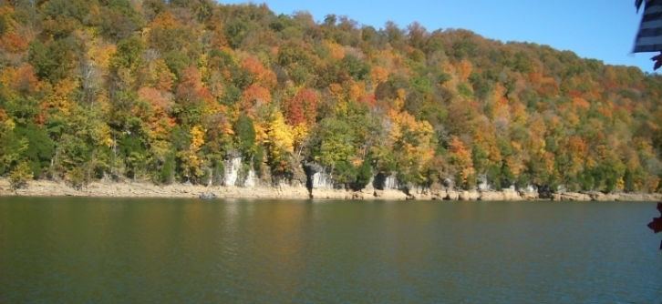
Campbell County is situated amidst a geological border region between the Cumberland Plateau in the northwest and the Appalachian Ridge-and-Valley Range in the southeast. This border area is characterized by several large, elongate ridges, namely Cross Mountain in the west and Cumberland Mountain, Walnut Mountain, and Pine Mountain to the north. Elevations vary widely across the county, ranging from 3,534 feet (1,077 m) at Cross Mountain to slightly less than 1,000 feet (300 m) a few miles away at Norris Lake. Norris Lake— an artificial reservoir created by the Tennessee Valley Authority in the 1930s— is the main body of water in the region. It is fed by the Clinch and Powell rivers as well as several large creeks, most notably Davis Creek, Big Creek, and Cove Creek. Cove Creek also feeds the much smaller Cove Lake— a recreational lake built by TVA in the 1930s as part of the Norris project— which is located near Caryville.
Most of the county's residents live in the southern half of the county, where La Follette, Jacksboro, and Caryville are located. Jellico, located along the Tennessee-Kentucky border, is the most notable populated area in the county's plateau section.
Portions of the county north of Walnut Mountain are part of the Cumberland River watershed. Portions of the county south of Walnut Mountain are part of the Tennessee River watershed. In the northwestern part of the county a large valley, known as Elk Valley, runs from southwest to northeast, from Pioneer to Jellico.
Adjacent counties
State protected areas
Demographics
As of the census of 2000, there were 39,854 people, 16,125 households, and 11,577 families residing in the county. The population density was 83 people per square mile (32/km²). There were 18,527 housing units at an average density of 39 per square mile (15/km²). The racial makeup of the county was 98.13% White, 0.30% Black or African American, 0.31% Native American, 0.16% Asian, 0.04% Pacific Islander, 0.16% from other races, and 0.91% from two or more races. 0.67% of the population were Hispanic or Latino of any race.
There were 16,125 households out of which 29.80% had children under the age of 18 living with them, 55.30% were married couples living together, 12.60% had a female householder with no husband present, and 28.20% were non-families. 25.40% of all households were made up of individuals and 11.60% had someone living alone who was 65 years of age or older. The average household size was 2.44 and the average family size was 2.91.
In the county, the population was spread out with 22.90% under the age of 18, 8.50% from 18 to 24, 28.00% from 25 to 44, 25.50% from 45 to 64, and 15.10% who were 65 years of age or older. The median age was 38 years. For every 100 females there were 93.00 males. For every 100 females age 18 and over, there were 90.90 males.
The median income for a household in the county was $25,285, and the median income for a family was $30,197. Males had a median income of $26,762 versus $19,138 for females. The per capita income for the county was $13,301. About 18.40% of families and 22.80% of the population were below the poverty line, including 32.00% of those under age 18 and 17.70% of those age 65 or over.
Coal mining
The Cumberland Plateau section of Campbell County is part of the massive Appalachian coalfield that dominates much of Central Appalachia, and thus the Jellico section of the county has more in common economically with southeastern Kentucky and West Virginia, whereas the southern parts of the county economically resemble East Tennessee. The coal seams near Jellico produced a slow-burning bituminous coal that helped make Campbell County Tennessee's largest coal-producing county in the early 20th century.
Tourism
Campbell County is part of the Norris Highlands. Much of Norris Lake is contained within its boundaries as well as several wildlife management areas such as the North Cumberland Wildlife Management Area. The county is home to two state parks— Cove Lake State Park near Caryville and Indian Mountain State Park near Jellico, and portions of Norris Dam State Park. There are two trail heads that lead to the Cumberland Trail located in Campbell County.