
Country United States Incorporated 1883 Elevation 298 m Population 2,304 (2013) Area code 423 | State Tennessee Founded 1878 Named for Jellico coal Zip code 37762 Local time Friday 4:11 PM | |
 | ||
Weather 10°C, Wind NW at 18 km/h, 31% Humidity Area 16.58 km² (16.32 km² Land / 21 ha Water) | ||
Driving south on interstate 75 in jellico tennessee
Jellico is a city in Campbell County, Tennessee, United States, on the State border with Kentucky, 58 miles (93 km) by road north of Knoxville. The population was 2,355 at the 2010 census.
Contents
- Driving south on interstate 75 in jellico tennessee
- Map of Jellico TN USA
- History
- Geography
- Demographics
- Economy
- Religion
- Notable people
- References
Map of Jellico, TN, USA
History
The name "Jellico" is a regional corruption of "angelica", an herb that grows in abundance in the surrounding mountains. The name was first applied to the mountains to the west and to the mountains' main drainage, Jellico Creek, which passes 5 miles (8 km) west of the city of Jellico and empties into the Cumberland River near Williamsburg, Kentucky.
In the early 1880s, a high quality bituminous coal was discovered in the Jellico Mountains, and with the completion of railroad tracks to the area in 1883, coal mines quickly sprang up throughout the area. The city of Jellico was initially founded as "Smithburg" in 1878, but changed its name to "Jellico" in 1883 to capitalize on the growing popularity of Jellico coal. The city was incorporated on March 7, 1883.
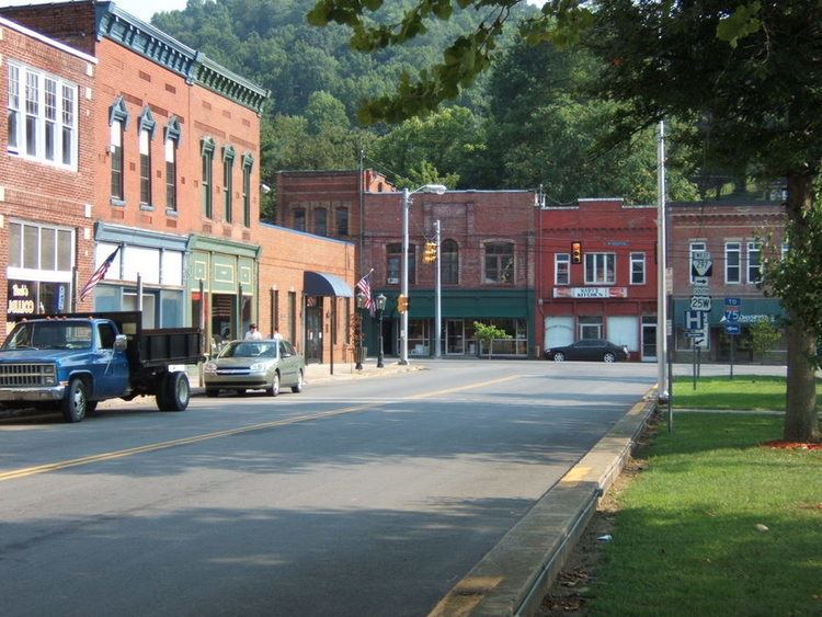
Throughout the 1890s and early 1900s, Jellico was one of the most productive coal fields in Kentucky and Tennessee. In 1906, a railroad car packed with dynamite exploded in Jellico, killing eight and destroying part of the town. The town quickly recovered, however, and many of the buildings in the Main Street area date from this period.
In 1971, Indian Mountain State Park was created at the site of a reclaimed strip mine in western Jellico. In 1999, much of North and South Main Street was placed on the National Register of Historic Places as the Jellico Commercial Historic District.
Geography
Jellico is located along the northern border of Tennessee at 36°34′57″N 84°7′50″W (36.582627, -84.130608). The city is situated amidst the Cumberland Mountains in the valley of Elk Creek, which flows north into Kentucky. Jellico spans the western bases and slopes of three steep hills that split the Elk Creek valley from the larger Clear Fork valley to the east. A prominent knob known as Indian Mountain rises nearly 1,000 feet (300 m) above Jellico to the west, and is visible from most of the city. This mountain and an adjacent lake are now home to Indian Mountain State Park. The larger Jellico Mountain dominates the area beyond Indian Mountain to the west, and Pine Mountain dominates the area beyond the Clear Fork Valley to the east.
Jellico is concentrated around the junction of U.S. Route 25W (North Main Street and 5th Street), which connects Jellico to Interstate 75 to the southeast and Corbin, Kentucky, to the north, and Tennessee State Route 297 (South Main Street), which connects Jellico with Huntsville to the southwest. The Tennessee-Kentucky state line forms Jellico's official northern boundary, although houses and businesses associated with the city are on both sides of the border.
According to the United States Census Bureau, the city has a total area of 6.4 square miles (16.5 km2), of which 6.3 square miles (16.3 km2) is land and 0.08 square miles (0.2 km2), or 1.15%, is water.
Demographics
As of the census of 2000, there were 2,448 people, 1,022 households, and 657 families residing in the city. The population density was 561.7 people per square mile (216.8/km²). There were 1,105 housing units at an average density of 253.5 per square mile (97.9/km²). The racial makeup of the city was 96.24% White, 1.96% African American, 0.16% Native American, 0.65% Asian, and 0.98% from two or more races. Hispanic or Latino of any race were 0.37% of the population.
There were 1,022 households out of which 26.7% had children under the age of 18 living with them, 44.1% were married couples living together, 16.2% had a female householder with no husband present, and 35.7% were non-families. 32.8% of all households were made up of individuals and 17.1% had someone living alone who was 65 years of age or older. The average household size was 2.29 and the average family size was 2.90.
In the city, the population was spread out with 21.0% under the age of 18, 8.7% from 18 to 24, 24.1% from 25 to 44, 25.1% from 45 to 64, and 21.0% who were 65 years of age or older. The median age was 42 years. For every 100 females there were 82.8 males. For every 100 females age 18 and over, there were 78.3 males.
The median income for a household in the city was $20,303, and the median income for a family was $25,709. Males had a median income of $27,619 versus $16,953 for females. The per capita income for the city was $11,587. About 28.8% of families and 31.9% of the population were below the poverty line, including 45.3% of those under age 18 and 23.2% of those age 65 or over.
Economy
Jellico Community Hospital is the largest employer with approximately 350 employees.
There are several restaurants, hotels/motels and gas stations located off Jellico's exit of Interstate 75, Exit 160. A Tennessee Welcome Center is located along the interstate just south of the state line.
Religion
Since 1922, Jellico has been the home of the denominational headquarters for the Church of God Mountain Assembly, a holiness Pentecostal Christian denomination.
Notable people
Jellico was the childhood home of Grace Moore, soprano star of opera, musical theatre, and film, and Homer Rodeheaver, hymnwriter, trombonist, and pioneer in the recording of sacred music.