
FIPS code 19-09955 Elevation 351 m Zip code 50523 Local time Monday 2:03 PM | Time zone Central (CST) (UTC-6) GNIS feature ID 0455056 Area 135 ha Population 361 (2013) Area code 515 | |
 | ||
Weather 22°C, Wind S at 48 km/h, 53% Humidity | ||
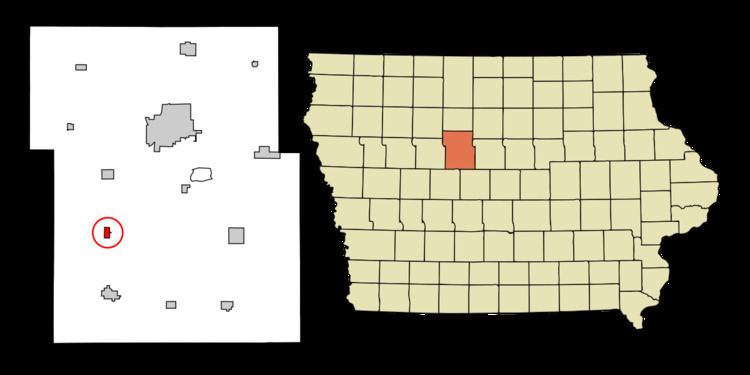
Callender is a city in Webster County, Iowa, United States. The population was 376 at the 2010 census.
Contents
- Map of Callender IA 50523 USA
- History
- Geography
- 2010 census
- 2000 census
- Education
- Transportation
- References
Map of Callender, IA 50523, USA
History
Between 1866 and 1870 the Des Moines Valley Railroad Company constructed tracks between Des Moines and Fort Dodge. The other end of the line originated at Keokuk, Iowa (at the confluence of the Des Moines and Mississippi rivers). As a result, several small towns were created by the railroad along the line to support track maintenance and to grow business. At 7 to 10 mi (11 to 16 km) intervals were 38 stops between Keokuk and Fort Dodge. Kesho, town that would become Callender, was the 36th stop.
According to the County Assessor’s records, the town of Kesho began south of the road (Thomas Street) on the east side of the railroad tracks. There, Gurmond and Thora Bean had established a store in 1867–68. The store was operational when the Des Moines Valley Railroad made it to Kesho in December 1869; however, a November 24, 1870 newspaper article from the Iowa Northwest Newspaper reads, “The city has disappeared from the face of the earth—not like Pompeii—but it has gone off on wheels. First the horse barn fell down, then the hotel was taken to pieces and moved off, and lately the depot has been hoisted on wheels, moved 9 miles (14 km) up the road and landed near the Sioux City Junction (Tara). Kesho is now inhabited by muskrats alone.” A new depot replaced the old one that existed until it was demolished in 1972. Post office records indicate that there was a post office in Kesho from 1873 until 1877.
In 1875 the town was renamed Callender in honor of Agnes and James Callender of Brooklyn Heights, New York City, New York who owned all of the land on the west side of the railroad tracks and much of the surrounding area—Webster’s Prairies. The Callenders donated land to the town for churches, the school, City Hall and the City Park. A second depot was built on the west side of the track, north of Main (Thomas) Street. The existing town retains much of the 1875 town form, including the donated properties.
Geography
Callender is located at 42°21′45″N 94°17′36″W (42.362592, -94.293268).
According to the United States Census Bureau, the city has a total area of 0.52 square miles (1.35 km2), all of it land.
2010 census
As of the census of 2010, there were 376 people, 162 households, and 111 families residing in the city. The population density was 737.3 people per square mile (284.8/km²). There were 178 housing units at an average density of 349.0 per square mile (134.8/km²). The racial makeup of the city was 98.7% White, 0.3% African American, 0.3% Native American, and 0.8% from two or more races.
There were 162 households of which 28.4% had children under the age of 18 living with them, 51.9% were married couples living together, 9.9% had a female householder with no husband present, and 31.5% were non-families. 28.4% of all households were made up of individuals and 15.4% had someone living alone who was 65 years of age or older. The average household size was 2.32 and the average family size was 2.85.
In the city, the population was spread out with 23.4% under the age of 18, 9.2% from 18 to 24, 20.2% from 25 to 44, 29.9% from 45 to 64, and 17.3% who were 65 years of age or older. The median age was 42.3 years. For every 100 females there were 98.9 males. For every 100 females age 18 and over, there were 94.6 males.
2000 census
As of the census of 2000, there were 424 people, 168 households, and 113 families residing in the city. The population density was 830.8 people per square mile (321.0/km²). There were 179 housing units at an average density of 350.7/sq mi (135.5/km²). The racial makeup of the city was 98.35% White, 0.24% African American, 0.71% Native American, and 0.71% from two or more races.
There were 168 households out of which 36.3% had children under the age of 18 living with them, 56.5% were married couples living together, 7.7% had a female householder with no husband present, and 32.7% were non-families. 28.0% of all households were made up of individuals and 15.5% had someone living alone who was 65 years of age or older. The average household size was 2.52 and the average family size was 3.14.
In the city, the population was spread out with 27.8% under the age of 18, 10.1% from 18 to 24, 27.1% from 25 to 44, 17.9% from 45 to 64, and 17.0% who were 65 years of age or older. The median age was 36 years. For every 100 females there were 90.1 males. For every 100 females age 18 and over, there were 90.1 males.
The following income data is from 2000. The median income for a household in the city was $33,906, and the median income for a family was $42,917. Males had a median income of $26,917 versus $24,250 for females. The per capita income for the city was $14,411. About 9.5% of families and 11.0% of the population were below the poverty line, including 18.3% of those under age 18 and 2.6% of those age 65 or over.
Education
Callender is currently part of Prairie Valley Community Schools.
The elementary school for the school district was in Callender from 1994 until 2010. The middle school was near Farnhamville and the high school was in Gowrie. Before that, Callender was the elementary and middle school for Prairie Community, a consolidated school district including Moorland, Callender, Gowrie, and Lanyon. From 1962 until 1974 Callender, Moorland and Gowrie each had elementary schools. Callender also had a junior high school and Gowrie also had a high school.
Transportation
Callender is at the intersection of County Roads P33 (Fairbanks Ave) and D43 (295th St).
The Union Pacific Railroad is on the east end of town
The Fort Dodge Regional Airport is located 20 miles northwest of town. It is primarily a general aviation airport, but it does have commercial links from Great Lakes Airlines.