
Country United States FIPS code 19-53895 Elevation 351 m Zip code 50566 Local time Saturday 8:04 AM | Time zone Central (CST) (UTC-6) GNIS feature ID 0459218 Area 3.83 km² Population 165 (2013) Area code 515 | |
 | ||
Weather 0°C, Wind NW at 16 km/h, 78% Humidity | ||
Moorland is a city in Webster County, Iowa, United States. The population was 169 at the 2010 census.
Contents
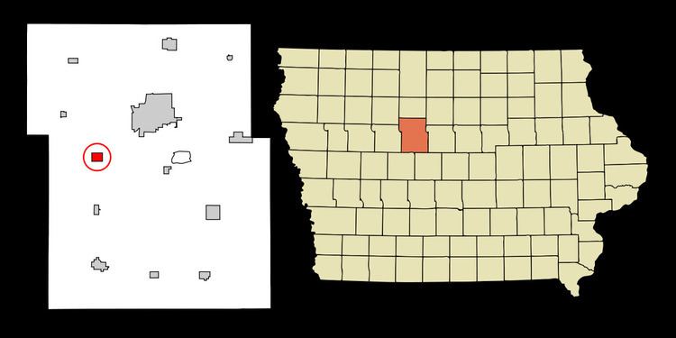
- Map of Moorland IA 50566 USA
- Geography
- 2010 census
- 2000 census
- Businesses
- Notable Families
- Government Buildings
- References
Map of Moorland, IA 50566, USA
Geography
Moorland is located at 42°26′32″N 94°17′37″W (42.442108, -94.293661).
According to the United States Census Bureau, the city has a total area of 1.48 square miles (3.83 km2), all of it land.
2010 census
As of the census of 2010, there were 169 people, 77 households, and 50 families residing in the city. The population density was 114.2 inhabitants per square mile (44.1/km2). There were 85 housing units at an average density of 57.4 per square mile (22.2/km2). The racial makeup of the city was 99.4% White and 0.6% from two or more races. Hispanic or Latino of any race were 1.8% of the population.
There were 77 households of which 24.7% had children under the age of 18 living with them, 45.5% were married couples living together, 7.8% had a female householder with no husband present, 11.7% had a male householder with no wife present, and 35.1% were non-families. 33.8% of all households were made up of individuals and 10.4% had someone living alone who was 65 years of age or older. The average household size was 2.19 and the average family size was 2.74.
The median age in the city was 46.1 years. 19.5% of residents were under the age of 18; 8.8% were between the ages of 18 and 24; 20.7% were from 25 to 44; 34.3% were from 45 to 64; and 16.6% were 65 years of age or older. The gender makeup of the city was 53.3% male and 46.7% female.
2000 census
As of the census of 2000, there were 197 people, 81 households, and 57 families residing in the city. The population density was 197.1 people per square mile (76.1/km²). There were 83 housing units at an average density of 83.0 per square mile (32.0/km²). The racial makeup of the city was 98.48% White, 0.51% from other races, and 1.02% from two or more races. Hispanic or Latino of any race were 2.03% of the population.
There were 81 households out of which 30.9% had children under the age of 18 living with them, 58.0% were married couples living together, 7.4% had a female householder with no husband present, and 29.6% were non-families. 27.2% of all households were made up of individuals and 11.1% had someone living alone who was 65 years of age or older. The average household size was 2.43 and the average family size was 2.84.
In the city, the population was spread out with 25.9% under the age of 18, 9.1% from 18 to 24, 24.4% from 25 to 44, 27.4% from 45 to 64, and 13.2% who were 65 years of age or older. The median age was 39 years. For every 100 females there were 93.1 males. For every 100 females age 18 and over, there were 94.7 males.
The median income for a household in the city was $43,750, and the median income for a family was $51,875. Males had a median income of $32,188 versus $25,417 for females. The per capita income for the city was $16,051. About 3.7% of families and 6.6% of the population were below the poverty line, including 9.8% of those under the age of eighteen and 8.3% of those sixty five or over.
Businesses
Ralph's Moorland Tab
Was Broken Pallet Company
Moorland Small Engine
Headquarters Salon
Secrets Used Clothing
Notable Families
Olson
Halligan
Sullivan
McCarville
Thompson
Hoffman
Aljets
Government Buildings
The current post office, built in 1991 under President George H. W. Bush, is the only government building. The current postmistress, Brenda Sorenson, has been serving the community since 1997.