
Country United States FIPS code 19-26940 Elevation 348 m Local time Thursday 12:15 PM Area code 515 | Time zone Central (CST) (UTC-6) GNIS feature ID 0456555 Zip code 50538 Population 358 (2013) | |
 | ||
Weather 3°C, Wind NE at 21 km/h, 60% Humidity Area 171 ha (168 ha Land / 3 ha Water) | ||
How to say or pronounce usa cities farnhamville iowa
Farnhamville is a city in Calhoun and Webster counties in the U.S. state of Iowa. The population was 371 at the 2010 census.
Contents
- How to say or pronounce usa cities farnhamville iowa
- Map of Farnhamville IA USA
- History
- Geography
- 2010 census
- 2000 census
- References
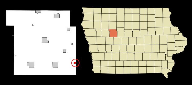
Map of Farnhamville, IA, USA
History
Farnhamville was platted in 1881 under the name Farnham, named in honor of R. E. Farnham, a railroad official. Postal authorities refused to accept the name Farnham, so town was renamed Farnhamville when the post office opened later in 1881. Farnhamville was incorporated as a city in 1892.
Geography
Farnhamville is located at 42°16′35″N 94°24′23″W (42.276421, -94.406493).
According to the United States Census Bureau, the city has a total area of 0.66 square miles (1.71 km2), of which, 0.65 square miles (1.68 km2) is land and 0.01 square miles (0.03 km2) is water.
2010 census
As of the census of 2010, there were 371 people, 180 households, and 111 families residing in the city. The population density was 570.8 inhabitants per square mile (220.4/km2). There were 201 housing units at an average density of 309.2 per square mile (119.4/km2). The racial makeup of the city was 98.4% White, 0.3% Native American, 0.3% Asian, 0.3% Pacific Islander, and 0.8% from two or more races.
There were 180 households of which 23.9% had children under the age of 18 living with them, 46.1% were married couples living together, 8.3% had a female householder with no husband present, 7.2% had a male householder with no wife present, and 38.3% were non-families. 34.4% of all households were made up of individuals and 18.9% had someone living alone who was 65 years of age or older. The average household size was 2.06 and the average family size was 2.53.
The median age in the city was 46.8 years. 18.6% of residents were under the age of 18; 8.9% were between the ages of 18 and 24; 20.8% were from 25 to 44; 27.5% were from 45 to 64; and 24.3% were 65 years of age or older. The gender makeup of the city was 46.4% male and 53.6% female.
2000 census
As of the census of 2000, there were 430 people, 195 households, and 130 families residing in the city. The population density was 659.6 people per square mile (255.4/km²). There were 213 housing units at an average density of 326.7 per square mile (126.5/km²). The racial makeup of the city was 98.14% White, 0.70% Native American, 0.47% from other races, and 0.70% from two or more races. Hispanic or Latino of any race were 0.70% of the population.
There were 195 households out of which 26.7% had children under the age of 18 living with them, 54.9% were married couples living together, 9.2% had a female householder with no husband present, and 33.3% were non-families. 30.8% of all households were made up of individuals and 23.6% had someone living alone who was 65 years of age or older. The average household size was 2.21 and the average family size was 2.69.
Age spread: 23.0% under the age of 18, 7.7% from 18 to 24, 20.5% from 25 to 44, 23.3% from 45 to 64, and 25.6% who were 65 years of age or older. The median age was 44 years. For every 100 females there were 86.1 males. For every 100 females age 18 and over, there were 87.0 males.
The median income for a household in the city was $29,107, and the median income for a family was $36,667. Males had a median income of $27,237 versus $22,813 for females. The per capita income for the city was $21,619. About 7.1% of families and 10.0% of the population were below the poverty line, including 11.2% of those under age 18 and 15.7% of those age 65 or over.