
Length 9.7 km | ||
 | ||
Restrictions: No tractor-trailers or vehicles over 15 tons on the Howard Landing Ferry. Length restrictions may also apply. Counties | ||
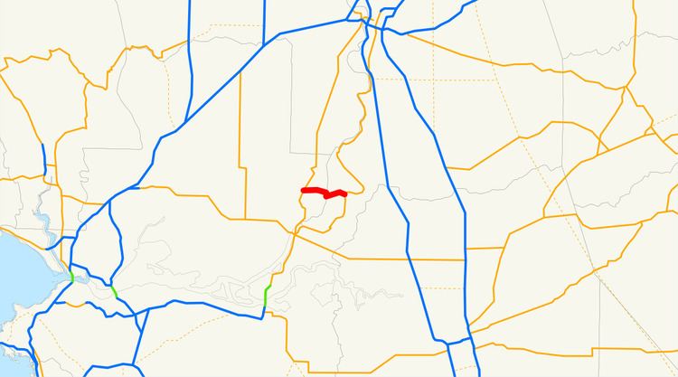
State Route 220 is a state highway in the U.S. state of California, defined to run between State Route 84 and State Route 160 on Ryer Island. At the eastern end of Ryer Island, the road crosses Steamboat Slough on the Howard Landing Ferry, a cable ferry.
Contents
Map of CA-220, Walnut Grove, CA 95690, USA
Route description
The route begins at State Route 84 in Solano County. It then heads eastward and follows the Howard Landing Ferry across the Steamboat Slough to its east end at State Route 160 in Sacramento County.
Major intersections
Except where prefixed with a letter, postmiles were measured on the road as it was in 1964, based on the alignment that existed at the time, and do not necessarily reflect current mileage. R reflects a realignment in the route since then, M indicates a second realignment, L refers an overlap due to a correction or change, and T indicates postmiles classified as temporary (for a full list of prefixes, see the list of postmile definitions). Segments that remain unconstructed or have been relinquished to local control may be omitted. The numbers reset at county lines; the start and end postmiles in each county are given in the county column.