
 | ||
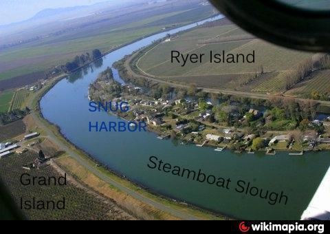
Ryer Island an island in the Sacramento-San Joaquin River Delta in Solano County, California surrounded by Miner Slough and Steamboat Slough at their confluence with the Sacramento River, 6.5 miles north-northeast of Rio Vista. The 4,750 ha (11,700-acre) island is named in honor of a California pioneer, Dr. Washington M. Ryer, and his family. A map prepared at the time of statehood shows the area divided by the west fork of the Sacramento River, with the western half identified as Priest Island and the eastern half identified as Sutter Island.
Map of Ryer Island, California 95690, USA
The California Department of Transportation (Caltrans) operates two vehicle ferry services to the island, connecting the following state highways:
Highway 220 then terminates at Highway 84 on Ryer Island, while the latter leaves the island north on a bridge, and towards West Sacramento.