
Length 4.064 km | ||
 | ||
County | ||
State Route 217 is a short two-and-a-half mile long spur route in the U.S. state of California.
Contents
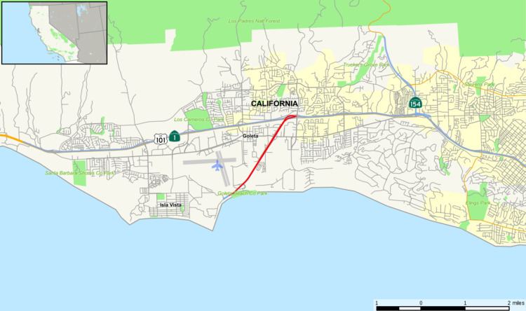
Map of CA-217, Goleta, CA, USA
Route description
It connects the University of California, Santa Barbara and the Santa Barbara Municipal Airport with U.S. Route 101, which is the major highway that connects Santa Barbara with other major cities along California's Pacific Coast. State Route 217 can be found about 6 miles (9.7 km) west of Central Santa Barbara. It is a freeway for its entire length.
This roadway is named Ward Memorial Boulevard after California State Senator Clarence C. Ward (1895-1955), who served the people of Santa Barbara County from 1941 to 1955.
Exit list
Except where prefixed with a letter, postmiles were measured on the road as it was in 1964, based on the alignment that existed at the time, and do not necessarily reflect current mileage. R reflects a realignment in the route since then, M indicates a second realignment, L refers an overlap due to a correction or change, and T indicates postmiles classified as temporary (for a full list of prefixes, see the list of postmile definitions). Segments that remain unconstructed or have been relinquished to local control may be omitted. The entire route is in Santa Barbara County.