
Length 61.59 km | ||
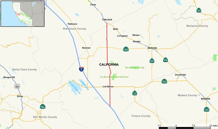 | ||
State Route 165 (SR 165) is a rural north–south state highway in central California, USA. It runs from Interstate 5 south of Los Banos to State Route 99 in Turlock.
Contents
Map of CA-165, California, USA
Route description
State Route 165 begins at the junction of Interstate 5 south of Los Banos and heads north on a rural two-lane highway known as Mercey Springs Road. The highway crosses the California Aqueduct north of Interstate 5 and enters Los Banos several miles later. It meets up with SR 152 and SR 33, known locally as Pacheco Boulevard. After leaving Los Banos, the highway then runs right through the San Luis National Wildlife Refuge and skirts the Great Valley Grasslands State Park to the west while crossing the San Joaquin River. At this point, the highway is known as Lander Avenue and meets up with SR 140 near Stevinson. It crosses the Merced River en route to Hilmar, then crosses into Stanislaus County for a short while, ending at SR 99 in Turlock.
Major intersections
Except where prefixed with a letter, postmiles were measured on the road as it was in 1964, based on the alignment that existed at the time, and do not necessarily reflect current mileage. R reflects a realignment in the route since then, M indicates a second realignment, L refers an overlap due to a correction or change, and T indicates postmiles classified as temporary (for a full list of prefixes, see the list of postmile definitions). Segments that remain unconstructed or have been relinquished to local control may be omitted. The numbers reset at county lines; the start and end postmiles in each county are given in the county column.