
Length 58 km | ||
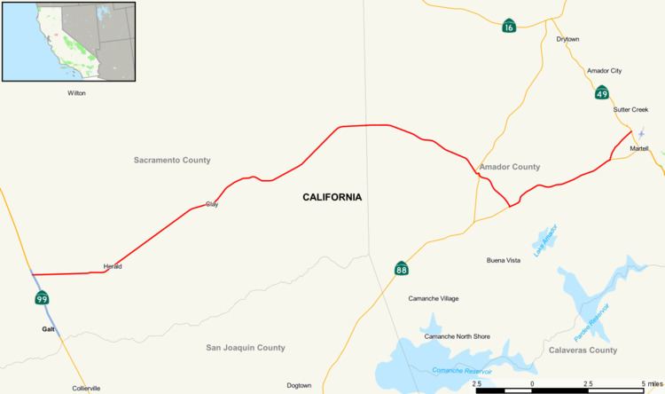 | ||
State Route 104 (SR 104) is a west–east state highway in California's Central Valley. It connects State Route 99 near Galt to State Route 49 in Sutter Creek via the city of Ione. It is known as Twin Cities Road from its western terminus up until just before Ione. Heading west past its western terminus along Twin Cities Road will lead to Interstate 5 and eventually to an end at State Route 160 north of Walnut Grove.
Contents
Map of CA-104, California, USA
Route description
The route begins in Galt in Sacramento County at SR 99. It then heads eastward, forming the northern boundary of the city of Galt. The route turns northeast, passing through Herald, near Rancho Seco Nuclear Generating Station and on to the community of Clay before entering Amador County. It then continues past Mule Creek State Prison and begins a short overlap with SR 124 in Ione. Afterwards, it exits the town and has another overlap with SR 88, where it goes through the community of Sunnybrook. Its eastern terminus is at SR 49 in Sutter Creek.
Major intersections
Except where prefixed with a letter, postmiles were measured on the road as it was in 1964, based on the alignment that existed at the time, and do not necessarily reflect current mileage. R reflects a realignment in the route since then, M indicates a second realignment, L refers an overlap due to a correction or change, and T indicates postmiles classified as temporary (for a full list of prefixes, see the list of postmile definitions). Segments that remain unconstructed or have been relinquished to local control may be omitted. The numbers reset at county lines; the start and end postmiles in each county are given in the county column.