
Phone +34 922 92 22 80 | Established 1954 | |
 | ||
Address Carretera General de Padrón, 47, 38750 El Paso, Santa Cruz de Tenerife, Spain Province Province of Santa Cruz de Tenerife Similar Roque de los Muchachos, Teneguía, Parques nacionales de España, Los Cancajos, Cumbre Vieja | ||
Caldera de Taburiente National Park (Spanish: Parque Nacional de la Caldera de Taburiente) is a national park on the island of La Palma, Canary Islands, Spain. It contains the enormous expanse of the Caldera de Taburiente, once believed to be a huge crater, but nowadays known to be a mountain arch with a curious crater shape, which dominates the northern part of the island. It was designated as a national park in 1954.
Contents
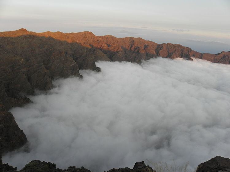
The caldera is about 10 km across, and in places the walls tower 2000 m over the caldera floor. The highest point is the Roque de los Muchachos on the northern wall, at 2426 m altitude, which can be reached by road. The telescopes of the Roque de los Muchachos Observatory are situated very close to the summit.
During the Spanish conquest of the Canary Islands in the 15th century, the caldera was the site of the last stand of the indigenous people of the archipelago, a branch of the Guanches known as Benahoaritas. It proved impregnable to the invading Spaniards, and they only defeated the Benahoarita by luring their leader out on the pretext of holding talks.
The Cumbrecita is at a lower point in the south-eastern part of the caldera's rim, giving a good view into the Caldera. In the south-west the caldera opens to the sea, through a riverbed known as Barranco de las Augustias. The Cumbre Nueva is a ridge that starts at the caldera and continues to the south.
The main flora of the national park comprises a large forest of Canary Island Pine, with important population of the endangered Canary Islands Juniper also present.
Geological origins
The caldera originated some 2 million years ago, with a massive shield volcano about 20 km in diameter. The caldera was not formed by an explosion of that volcano however, but by erosion starting from the volcano's original crater.
Name
The word "caldera" means "cauldron" in Spanish. In 1815 the great German geologist Christian Leopold von Buch visited the Canary Islands during which he visited the island of Tenerife where he was taken to the Caldera de las Cañadas. He visited La Palma after he had been to Tenerife and in his journal he makes it clear that he was able to distinguish between a caldera of volcanic origin and the erosional origins for the caldera Taburiente. Following his return to Germany he published his journal and he introduced the term "Caldera" to the geological vocabulary.
Taburiente is not a Spanish word but derives from the Guanche language and means "plain, level".