
Country Italy Frazioni Olcella Demonym(s) Bustesi Area 12.8 km² Postal code 20020 Dialling code 0331 | Elevation 180 m (590 ft) Time zone CET (UTC+1) Local time Tuesday 4:43 PM | |
 | ||
Weather 15°C, Wind N at 31 km/h, 18% Humidity | ||
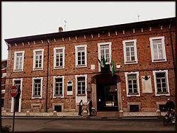
B g busto garolfo
Busto Garolfo is a comune (municipality) in the Metropolitan City of Milan in the Italian region Lombardy, located about 25 kilometres (16 mi) northwest of Milan.
Contents
- B g busto garolfo
- Map of 20020 Busto Garolfo Metropolitan City of Milan Italy
- Busto garolfo cops tel chi el telun
- History
- Geography
- Twin towns
- References
Map of 20020 Busto Garolfo Metropolitan City of Milan, Italy
Busto garolfo cops tel chi el telun
History
The first historical information of the village of Busto Garolfo dates back from a document of 992 AD. At the end of the 13th century there were 3 altars in honor of St. Bartholomew, St. Innocent and St. Margaret, over the ancient church of St. Salvatore, built by the noble family Della Croce which owned many lands in the area since 1317. In 1464 Stefano Della Croce in his last will ordered his heirs to build a chapel in honor of the Virgin in the main church of St. Salvatore. During the Late Middle Ages, Busto Garolfo before became a feud of the Maggi family, then of the Arconati family and in the end of the Losetti family. Finally in 1664 Giambattista Losetti sold the town to Giuseppe Arconati, to which the King of Spain conferred the title of Marquess of Busto Garolfo.
After more than a century of Austrian domination, the town became involved actively in the events that led to the unification of Italy. During the Italian Wars of Independence his territory was the scene of great movements of the Italian troops and the Austrian army, especially during the Battle of Magenta in 1859.
Geography
Busto Garolfo is located in the higher Po Valley. This area is called "Alto-Milanese" because of its location in the territory between the provinces of Milan and Varese. The town has got only one suburb named Olcella and located toward the north-western border. The Villoresi channel flows through the village. The lack of a nearby river required his construction, ended in 1890, to irrigate the corn fields in the area. Historically in the centre of the town there were two great weaving companies, now demolished to make way for lots of apartment buildings. In the post-war period the industrial area has spread to the East, in which there are various kinds of companies, small and medium-sized.