
Population 173 (2011) Civil parish Burnham Norton Area 14.27 km² | OS grid reference TF829438 Sovereign state United Kingdom Local time Tuesday 6:50 AM | |
 | ||
Weather 3°C, Wind W at 16 km/h, 89% Humidity District King's Lynn and West Norfolk | ||
Burnham Norton is a village and civil parish in the English county of Norfolk. Burnham Norton is one of the Burnhams, a group of adjacent villages in north Norfolk. It is situated, on the A149, some 2 km north of the larger village of Burnham Market, 10 km west of the small town of Wells-next-the-sea, 35 km northeast of the larger town of King's Lynn, and 60 km northwest of the city of Norwich.
Contents
Map of Burnham Norton, UK
The civil parish has an area of 14.27 km2 and in the 2001 census had a population of 76 in 37 households, the population increasing to 173 at the 2011 Census. For the purposes of local government, the parish falls within the district of King's Lynn and West Norfolk.
The village is located close to the coast, and overlooks the tidal Norton Marshes and Scolt Head Island NNR.
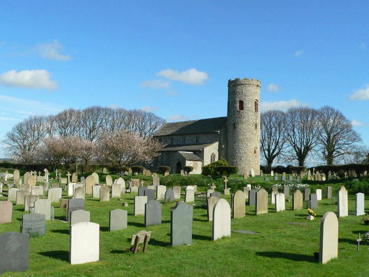
Church of St Margaret
The church of Burnham Norton St Margaret is one of 124 existing round-tower churches in Norfolk, and is a Grade I listed building. David Jamieson VC is buried in the churchyard, as is Diana, Princess of Wales's great aunt, Lady Margaret Douglas-Home. Richard Woodget, the master of the Cutty Sark is also buried here.