
Time zone CET (UTC+1) Website www.buren.nl | Elevation 5 m (16 ft) Area code 0344, 0345 Area 142.9 km² | |
 | ||
Postcode Parts of 4000 and 4100 ranges Weather 6°C, Wind W at 8 km/h, 92% Humidity | ||
Nederland buren
Buren ( pronunciation ) refers to both a municipality and a town in the Betuwe region of the Netherlands. The title "Count or Countess of Buren and Leerdam" is held by the Dutch monarchy due to Prince William of Orange's marriage to the Countess of Buren, Anna of Egmont, in 1551. As a result, the county and the town of Buren fall under the control of the Royal House of Orange-Nassau.
Contents
Geography
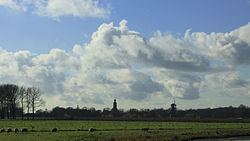
Buren is located in Gelderland, a province of the Netherlands. The landscape mostly consists of hills and other rocky structures with the Korne River flowing through it.
Population Centers
Population centers include:
The City of Buren
The earliest known reference of the settlement dates back to 772. The castle was built by the Lords of Buren and was first mentioned in 1298. The town was granted city rights in 1395 by Sir Alard IV of Buren. This led to the construction of a defensive wall and a moat, significant portions of which still exist. In 1492, the region was promoted to a county (i.e. a territory ruled by a count) but had limited economic influence due to its geographic isolation. By 1574, the previously Catholic parish church of Saint-Lambert (Dutch: Sint Lambertus) became Calvinist Reformed Protestant.
The Castle eventually came into the possession of the House of Orange, the royal family of the Netherlands. The Dutch royal family has been known to use the name van Buren as an alias to give themselves some degree of anonymity. The Castle was gradually demolished between 1804 and 1883. The eighth president of the United States, Martin Van Buren, traced his ancestry to inhabitants of the city, who had taken the surname Van Buren after relocating to the Dutch colony of New Netherland in what is now the state of New York.
Historical Points
Buren has two museums: