
Topo map USGS BUNKER HILL Prominence 851 m | Elevation 3,498 m | |
 | ||
Easiest route From Kingston Summit, southeast along a 4-wheel drive road and then the ridgeline, Class 2 scramble Similar Troy Peak, Currant Mountain, North Schell Peak, Matterhorn, Diamond Peak | ||
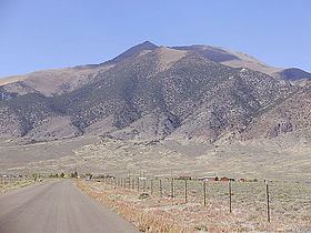
Bunker Hill is the highest mountain in Lander County, within the Toiyabe Range of central Nevada, United States. It is the twenty-second highest mountain in the state. The peak is located within the Austin Ranger District of the Humboldt-Toiyabe National Forest, about 17 miles south of the small town of Austin and just northwest of the small town of Kingston.
Map of Bunker Hill, Nevada 89310, USA
References
Bunker Hill (Nevada) Wikipedia(Text) CC BY-SA