
Topo map USGS Troy Canyon Prominence 1,460 m | Elevation 3,445 m | |
 | ||
Easiest route Southeast ridge: steep hike/scramble Similar Currant Mountain, North Schell Peak, Matterhorn, Hole in the Mountain Peak, Bunker Hill | ||
Troy peak nv panorama
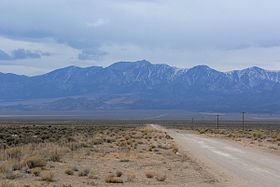
Troy Peak is the highest mountain in the Grant Range in northeastern Nye County, Nevada, United States. It is the thirty-sixth highest mountain in Nevada. Troy Peak also ranks as the third-most topographically prominent peak in Nye County and the fourteenth-most prominent peak in the state. The summit is located 72 miles (116 km) southwest of the city of Ely, within the Grant Range Wilderness of the Humboldt-Toiyabe National Forest.
Contents
Map of Troy Peak, Nevada, USA
Troy peak nevada
References
Troy Peak Wikipedia(Text) CC BY-SA