
Existed: 1983 – present Constructed 1983 | History: Completed in 1986 Length 10 km | |
 | ||
North end: Woodlands Checkpoint (Johor–Singapore Causeway) | ||
Bukit timah expressway 4
The Bukit Timah Expressway (abbreviation: BKE) is a highway in Singapore that starts at the Pan Island Expressway in Bukit Timah and travels north to the Woodlands Checkpoint and the Johor–Singapore Causeway.
Contents
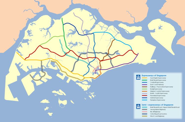
Map of BKE, Singapore
History
Construction began in 1983 and required the new roads to connect such as Bukit Panjang. New interchanges at Mandai Road and Woodlands Road were also added as well. Kampong roads were demolished such as Jalan Kwok Min, Lorong Kingkit and Lorong Garpu.
Before the Kranji Expressway was completed, BKE was the shortest expressway in Singapore, at about 10 km (6.2 mi). This expressway is a six-lane dual carriageway, with three lanes on either side. In 2003, the LTA began work to convert a section of the expressway, from the intersection with the Kranji Expressway to that with the Seletar Expressway, into a four-lane dual carriageway. This was completed in mid-2005.
Features
The Bukit Timah Satellite Earth Station is located near the Chantek flyover.
The huge fence of Kranji-Marsiling MRT tracks can be found along Woodlands Avenue 3.