
Time zone EAT (UTC+3) Area 1,046 km² | Website bugiri.go.ug | |
 | ||
Bugiri District is a district in Eastern Uganda. Like most other Ugandan districts, it is named after its 'chief town', Bugiri, where the district headquarters are located.
Contents
Map of Bugiri, Uganda
Location
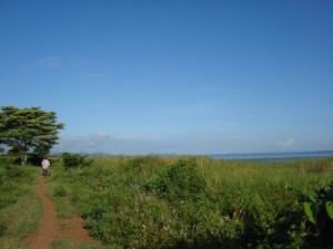
Bugiri District is bordered by Namutumba District and Butaleja District to the north, Tororo District to the northeast, Busia District to the east, Namayingo District to the southeast, Mayuge District to the southwest and Iganga District to the west. Bugiri, the district headquarters is located approximately 77 kilometres (48 mi), by road, east of Jinja, the largest city in Busoga sub-region. The coordinates of the district are:00 33N, 33 45E (Latitude:0.5500; Longitude:33.7500).
Overview
Bugiri District was carved out of Iganga District, to which it used to belong. The land surface is characterized by gentle undulating hills with few higher residual features. Another feature of the district is its being located in a flat and rolling topographical zone with 90% of its landmass constituting the drainage basins of Lake Victoria and Lake Kyoga. As a result, there are numerous swamps that criss-cross the road network, making the cost of the road improvement costly. In July 2010, the southern part of Bugiri District was split off to form Namayingo District. Bugiri District is part of Busoga sub-region, which is conterminous with Busoga Kingdom, one of the constitutionally recognised kingdoms in Uganda. According to the 2002 national census, the sub-region was home to an estimated 2.5 million people at that time. The districts that constitute Busoga sub-region include the following:
Population
The national population census conducted in 1991 estimated the district population at about 171,300. The 2002 national census estimated the population of the district at approximately 237,400. The annual population growth rate in the district is calculated at 6.1%. In 2012 the population of Bugiri District was estimated at approximately 426,800.
Economic activities
Agriculture forms the backbone of the district, as it does in the majority of districts in the country. The main crops include:
Tilda Uganda Limited (TUL), a commercial agricultural company, grows rice on a commercial basis at Kibimba Rice Scheme, in the extreme east of Bugiri District. Private out growers also sell their produce to TUL.
Due to the abundance of freshwater bodies in the district, commercial fishing is actively practiced by many in Bugiri District. At one time, the district produced in excess of forty (40) metric tones of fish on a daily basis. Unfortunately, due to unregulated fishing, the fish reserves in Lake Victoria have been severely disrupted to near-depletion. The daily catch has since markedly fallen from those high numbers. At the height of the fish boom, 75% of the output was exported (mainly to Western Europe), 20% was consumed locally and 5% was lost in processing.